York South-Weston Councillor Office
York South-Weston Profile - 2021 Census
York South-Weston Profile - 2016 Census
Need assistance reading content? Call 311 or email cityplanning@toronto.ca.
A road classification system designates streets into different groups or classes according to the type of service each group is intended to provide. This is a fundamental tool for urban development and road management. Grouping roads with similar functions can improve transportation planning, road infrastructure design, maintenance, traffic and road operations.
Every street owned by the City of Toronto has been given one of five classifications (with the exception of public laneways).
The City of Toronto will resurface the streets listed below. Our inspection of these roads shows that they need resurfacing and sections of damaged curb and/or sidewalk need to be replaced to bring them to a state of good repair. This project is part of the Council-approved 2026 Capital Works Program to renew aging City roads and sidewalk for current and future needs.
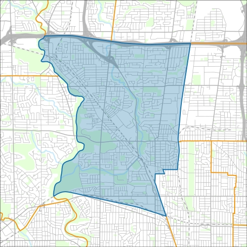
York South-Weston:
Pre-Construction Notice (Dated: January 21, 2026)
All construction notices below are organized by street name.
Basement Flooding Protection Program – Fairbank-Silverthorn Storm System Phase 2: Local Collector Storm Sewers
Basement Flooding Protection Program – Fairbank-Silverthorn Storm System Phase 2: Construction on Landour Avenue
Basement Flooding Protection Program – Fairbank-Silverthorn Storm System Phase 2: Construction on Woodborough Avenue and Castlefield Avenue
Basement Flooding Protection Program – Fairbank-Silverthorn Storm System Phase 2: Construction at Woodborough Park
Black Creek Drive (over Black Creek) Bridge Rehabilitation
Cornelius Parkway (from Rustic Road to Floral Parkway) Watermain Replacement
Culford Road (from Garside Crescent to Harrow Drive) Combined Sewer Replacement
Cynthia Road (from Scarlett Road to the end of Cynthia Road), Frimette Crescent and Brendwin Drive (from East Drive to the end of Brendwin Drive) Watermain Cleaning and Relining
Dalbeattie Avenue (and Farnsworth Drive, Lockerbie Avenue, Deerhurst Avenue between Gary Drive and Woodward Avenue) Watermain Cleaning and Relining
Donald Avenue and Trowell Avenue Road Reconstruction (from Kane to Silvethorn) and Watermain Replacement on Scott Road (from Trowell Avenue to Donald Avenue)
Eglinton Avenue (from Jane Street to 3601 Eglinton Avenue West) Storm Sewer Replacement
Eglinton Avenue West (over Humber River) Bridge Pier Rehabilitation
Elm Street (from King Street to Church Street) Road Resurfacing
Falstaff Avenue (between Maidstone Street and Culford Road) Road Resurfacing and Sidewalk Installation
Gary Drive (from Academy Road to Pelmo Crescent) and Pelmo Crescent (from Gary Drive to Kames Avenue) Watermain Cleaning and Relining
Gordon Mackay Road and at 2050 Jane Street Watermain Cleaning and Relining
King Street (from Weston Road to Jane Street) Watermain Replacement
Laneway Reconstruction of Ln S Eglinton W Scott (from Scott Road to Keele Street)
Lapp Street (between Northland Avenue and McCormack Street) Watermain Cleaning and Relining
Lawrence Avenue West (from Little Avenue to Pine Street) and Little Avenue Watermain Replacement and Road Resurfacing
MacDonald Avenue Watermain Replacement
Maple Leaf Drive (from Jane Street to Black Creek Drive) Watermain Replacement and Road Resurfacing
Noranda Drive, Monarchdale Avenue, Westchester Road and Parkchester Road – Intersection Improvements
Pelmo Crescent (between Kames Avenue and Longview Drive) and Longview Drive, Watermain Cleaning and Relining
Pelmo Crescent (from Woodward Avenue to 5 metres west of Longview Drive), Longview Drive (from Pelmo Crscent to Ettrick Crescent), Ettrick Crescent, Boylen Street, Uphill Avenue and Woodward Avenue (from Jane Street to 10 metres south of Uphill Avenue) Watermain Cleaning and Relining
Queenslea Avenue (from Pelmo Crescent and Longview Drive to Langside Avenue), Watermain Cleaning and Relining
Rockcliffe Boulevard (from 40 metres south of Rockcliffe Court to Terry Drive) and extension of Rockcliffe Court to Symes Road, Watermain Cleaning and Relining
Rosemount Avenue (from Queenslea Avenue to Purdy Crescent) Watermain Replacement
Runnymede Road (from Liverpool Street to St Clair Avenue W)
Sheffield Street (from 86 Ingram Drive to Kincort Street) Storm Sewer Replacement and Sidewalk Construction
Suntract Road and 2050 Jane Street, Watermain Cleaning and Relining
Vimy Avenue (from Lawrence Avenue West to MacDonald Avenue) Watermain Replacement and Road Resurfacing
Wilby Crescent New Sidewalk, Road Resurfacing, Road Reconstruction
Wright Avenue and other local roads – Basement Flooding Protection Program Sanitary and Storm Sewer Upgrades on
If you would like more information about this construction in your neighbourhood, please visit T.O. INview.
Within the Feature Filter:
Then, in the top left search bar:
If you need more information, please call 311.
The City of Toronto ensures that tenants live in safe, well-maintained buildings through RentSafeTO, a bylaw enforcement program. Building owners must comply with the bylaws within the program or face financial penalties.