The City provides the public with convenient and reliable road information to allow travellers the opportunity to make informed decisions on the best timing, mode, and route of their trip.
Information about traffic conditions on the City’s roadways is pulled from a variety of databases (e.g. traffic cameras, road restrictions database, Bluetooth devices) and are disseminated via variable message signs, social media and the City’s website.
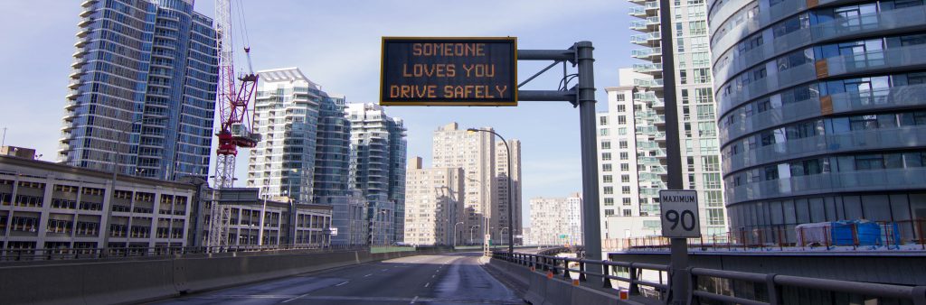
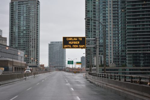
Variable Message Signs (VMS) are electronic signs used on the roadway to provide information to travellers in priority order. The City displays several types of messages on its VMS.
The operators at the City’s Transportation Operations Centre (TOC) control the information that is being displayed on the Signs by verifying current road conditions through traffic cameras.
For provincially maintained signs, requests should be directed to the Ministry of Transportation for the two westbound Gardiner Expressway VMS (express and collector lanes between Highway 427 and Kipling Avenue) and the northbound Don Valley Parkway VMS at York Mills Road.
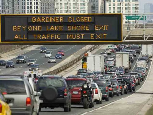
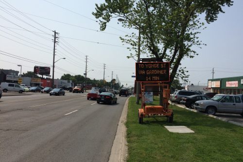
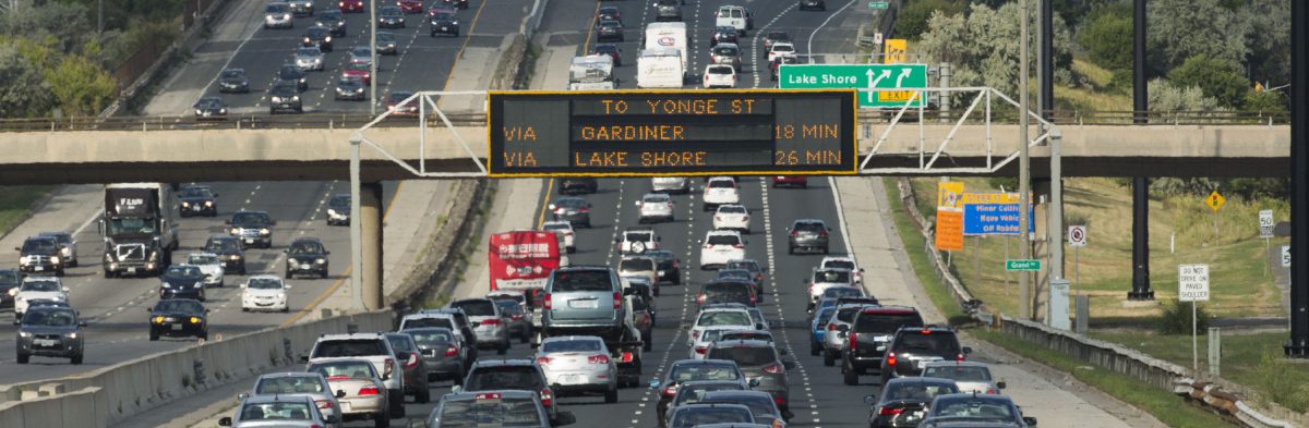
In the past, the City of Toronto has provided congestion information about the road ahead on its variable message signs. These messages have been qualitative such as:
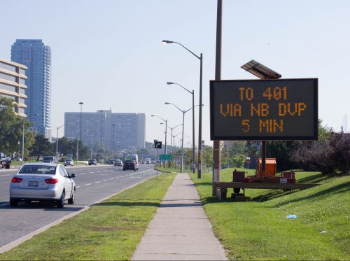
Since 2014, these qualitative messages are being supplemented with actual travel times to specific destinations on its expressways.
The City will be expanded to operate on selected arterials roads as part of the City’s Congestion Management Plan.
Motorists will now be more informed about delays and the impacts that they will have on their commute. More detailed information will allow motorists to make better decisions regarding whether or not to stay on the expressway or seek alternate routes. Along the Lake Shore and Gardiner, the system will provide valuable comparative information to motorists regarding the two viable options they have to reach their downtown destination.
The system automatically provides travel times to the signs, however, the City’s traffic operators who monitor the roads 24 hours a day, seven days a week, have the ability to monitor and override the system to display messages in the event of an emergency, incident or amber alert.
The City conduct periodic audits on the system by comparing the system logs against travel time runs to ensure that the system is running as it should.
The system uses a combination of Bluetooth and Wi-Fi readers to detect vehicles anonymously on the road that are either equipped with such enabled devices or have drivers or passengers with enabled cell phones. The system takes an average of the readings and then reports a representative travel time to be displayed on the variable message signs.
Bluetooth/WiFi readers are small, low powered devices that have the ability to anonymously pick up Wifi or Bluetooth enabled devices such as those found in cell phones, cars, or other electronic devices such as printers, faxes, etc. When two such readers are placed in sequence along a particular segment of a road, readings can be matched up between units to estimate the average travel time experienced along the route segment.
When a Bluetooth or WiFi device is in ‘search’ mode for a connection, the device sends out ping pulses. The Bluetooth/WiFi readers pick up on the pulses, encrypt the device MAC ID and stores the information until a match is found at a downstream location. Once the encrypted device IDs are paired, the ID information is deleted and a record is generated based on the time/stamp and segment travel time. Unpaired device readers are also discarded after a certain period.
The actual Bluetooth readers are installed in the existing roadside traffic controller cabinets on Gardiner Expressway, Don Valley Parkway and Lake Shore Blvd.
The system has the capability to adjust the polling frequency. The system is currently polling and updating the signs every minute.
The device MAC IDs are completely anonymous and not traceable as there is no database linking device MAC IDs to specific users. Moreover, the IDs are not stored in the system records and even while the system is looking for a match, the stored IDs are encrypted.
There are no specific link travel times stored for specific users (i.e. the system cannot be used to identify a specific user’s speed or travel time). Hence, there is no way for anyone to be capable of working backwards through the system to identify specific users and times as the information simply isn’t there. The anonymous nature of this technology has made it a very common approach to detecting general traffic conditions by road authorities throughout North America and other parts of the world.
The system stores travel time records as well as the messages that are being displayed on the signs. The travel time records include: date/time stamp, Bluetooth/Wi-Fi pair, and average travel time based on specific readings. No information regarding specific ping readings is stored by the system. The messaging records include sign location, date/time stamp, and actual message displayed.
The records are stored on a secure local database at the City of Toronto’s Transportation Operations Centre.
The City uses Twitter and E-Updates to keep subscribers apprised of traffic updates around Toronto. They can get notified immediately about unscheduled road or lane incident and closure information on the City’s expressways and major arterials.
The public can subscribe to City E-Updates by going to the Toronto E-Updates website to receive emails about unscheduled road or lane incident and closure information for the City’s expressways (e.g. Expressway, Don Valley Parkway, Allen Road) and major arterials (e.g. Lake Shore Boulevard). Typically, the number of emails sent to subscribers are unpredictable, but reflect current traffic conditions.
In addition, the public can follow the City’s four Twitter feeds that is maintained by the Traffic Management Centre (TMC) to keep the public informed about traffic.
The Connected Citizens Program offers a platform for the City and its road users to come together and share real-time traffic data with one another through the traffic app Waze. With access to the City’s data, Wazers will be more informed about planned and unplanned construction, events, road closures, and anything else that may cause delays when travelling within or through the city. In exchange, the City receives real-time user information about what is happening on the streets. This allows the City to respond quickly and efficiently to accidents and congestion, easing gridlock and improving safety for all road users.