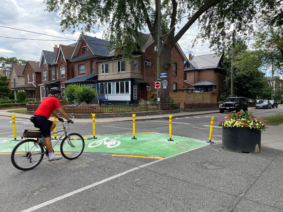
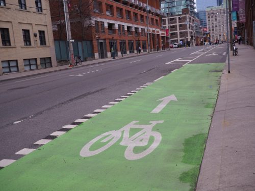
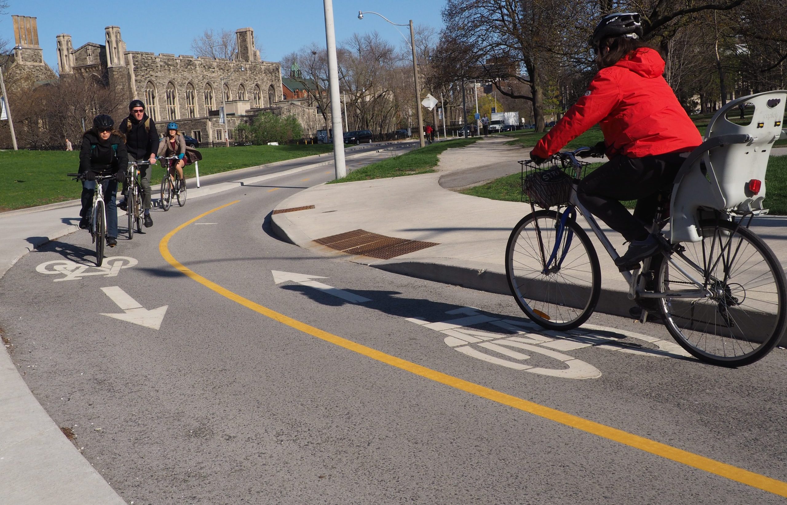
 Designated bicycle lanes are a dedicated part of the roadway for the exclusive use of people cycling. Other road users may not lawfully drive, stand, stop or park in a designated bicycle lane.
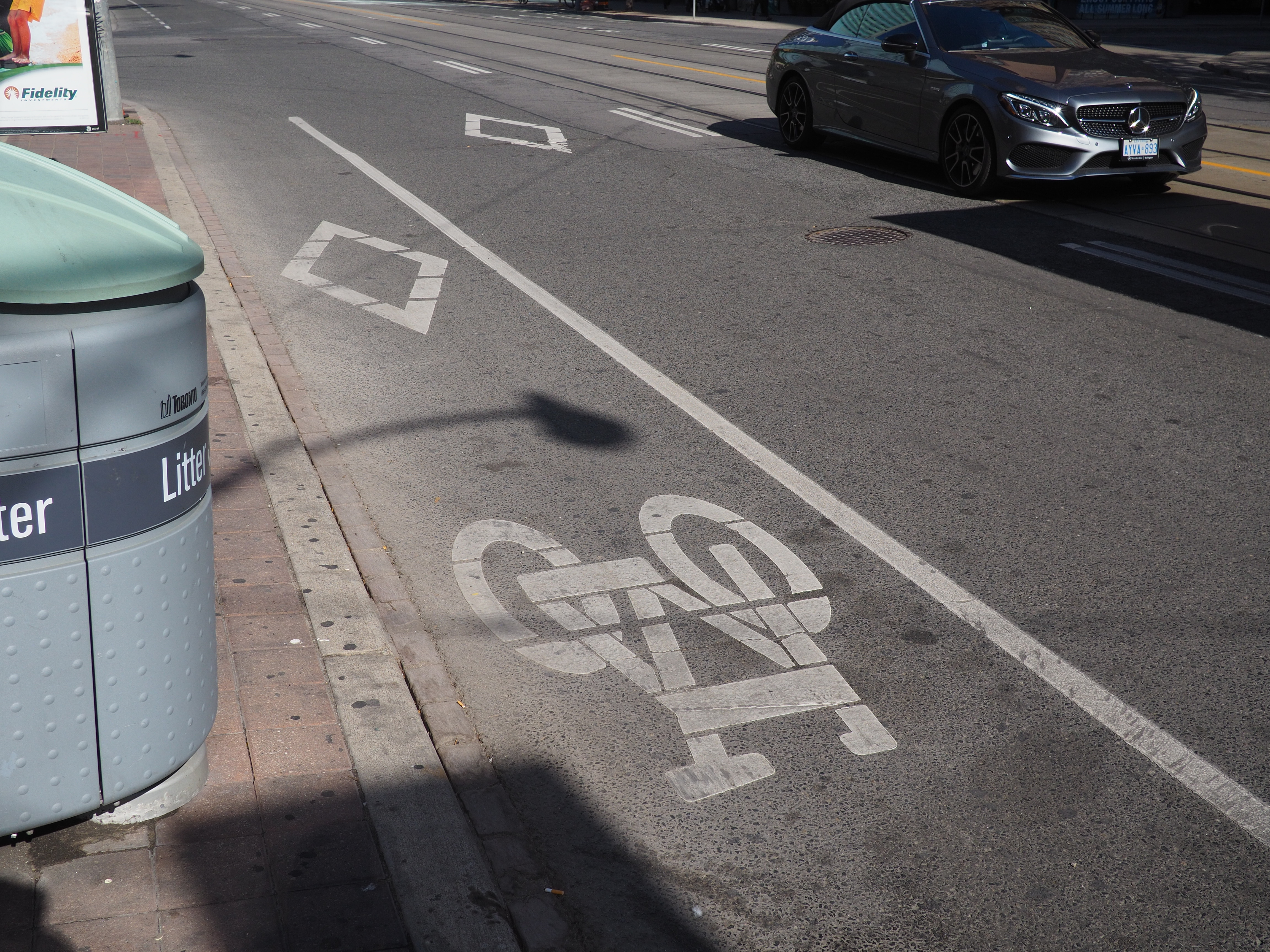
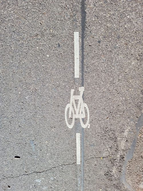
The diamond marking in bicycle lanes is the symbol for a “reserved lane.” Every lane with a diamond in it has accompanying lane restriction by-laws.
Contra-flow bicycle lanes allow people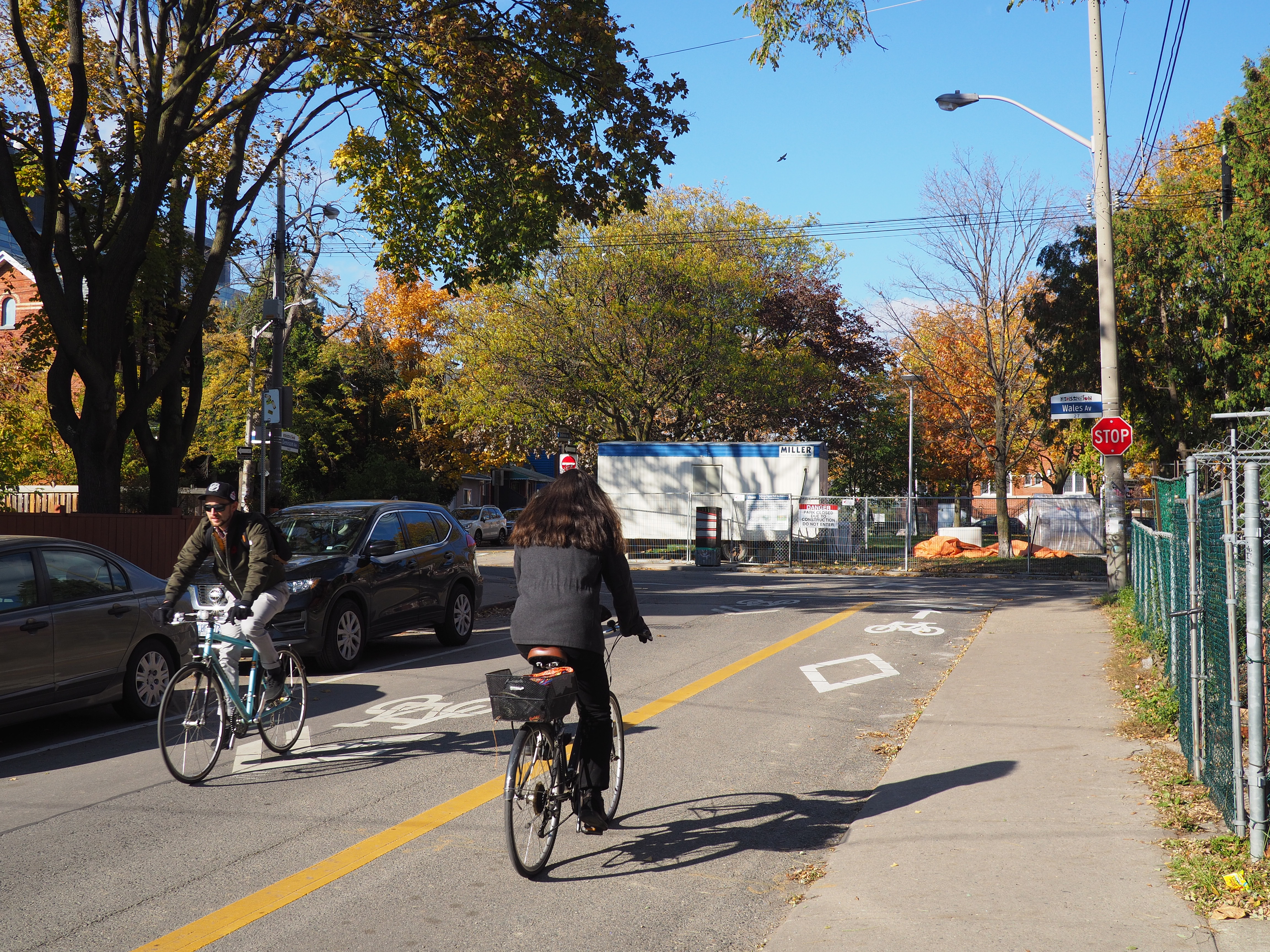 to cycle in two directions on a street that is one-way for motor vehicles. Bicycle symbols and diamonds are located inside the contra-flow bicycle lane. The diamond symbol is the symbol for a “reserved” lane. Every lane with a diamond in it has accompanying lane restriction by-laws. The contra-flow bicycle lane also features painted arrows, communicating that people must only cycle in one direction in this lane. When travelling in the opposite direction, people will cycle on the roadway in shared traffic or in a designated bicycle lane.
The benefits of contra-flow bicycle lanes include:
Cycle tracks are designated lanes for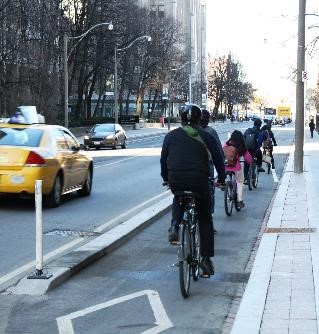 bicycles that are adjacent to the roadway, but are either raised to sidewalk level or physically separated from vehicular traffic by concrete or poured curbs, planter boxes, flexible bollards or concrete barriers. Learn more about the criteria for using various types of physical separation in Section 3.1.4 of the On-street Bikeway Design Guidelines.
Cycle tracks help distinguish the area for cycling from motor vehicle traffic (more than a painted bicycle lane), which creates a safer environment. The diamond marking in cycle tracks is the symbol for a “reserved lane.” Every lane with a diamond in it has accompanying lane restriction by-laws.
Electric bicycles that require muscular power to operate (including electric cargo bikes and tricycles) are permitted in cycle tracks. Learn more about the rules for rideables in Toronto.
Some cycle tracks have spaces for vehicle parking beside the lane. When passengers and drivers are exiting their vehicles, they must first ensure the cycle track is clear. Pedestrians crossing the street must treat the cycle track as a live vehicle lane and wait until the lane is clear before crossing.
One-way (uni-directional) cycle tracks run in the same direction of traffic on each side of the road, while two-way (bi-directional) cycle tracks allow bicycle movement in both directions on one side of the road.
The decision to install one-way or two-way cycle tracks depends on location, network and project-specific factors. One-way cycle tracks are generally the default design in Toronto, as they are more intuitive for people cycling and present fewer conflicts at intersections or transition points, compared to two-way cycle tracks.
|
|
|
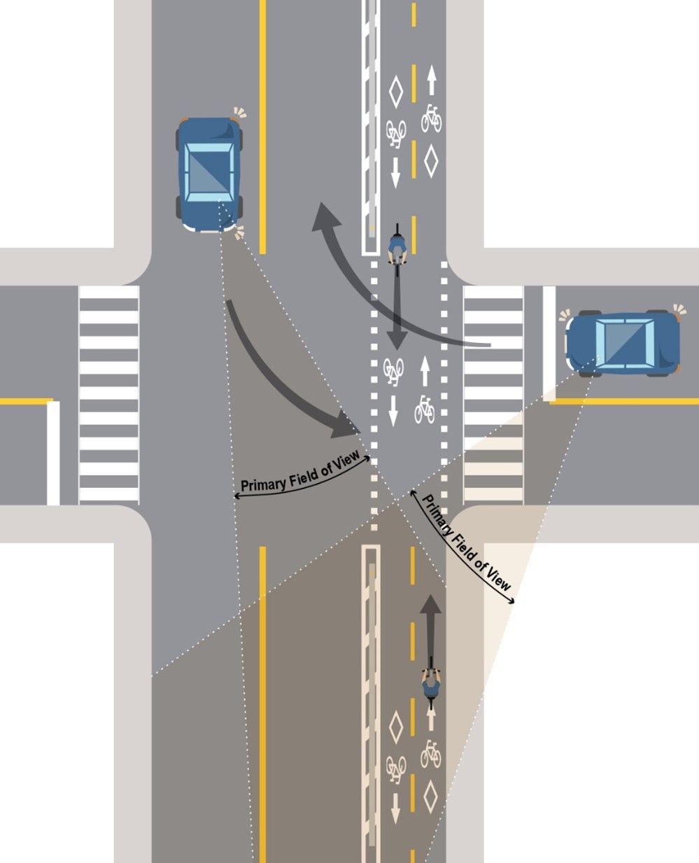
Two-way cycle tracks also present challenges for turning drivers who must anticipate cycling traffic from both directions, and therefore pose a greater risk to the safety of people cycling, as demonstrated in the diagram below.
Section 3.1.1 of the City of Toronto’s On-street Bikeway Design Guidelines include examples where two-way cycle tracks are appropriate:
While two-way cycle tracks are appropriate in various contexts, additional consideration and measures are needed at intersections to improve the safety of vulnerable road users. Measures that are commonly used include:
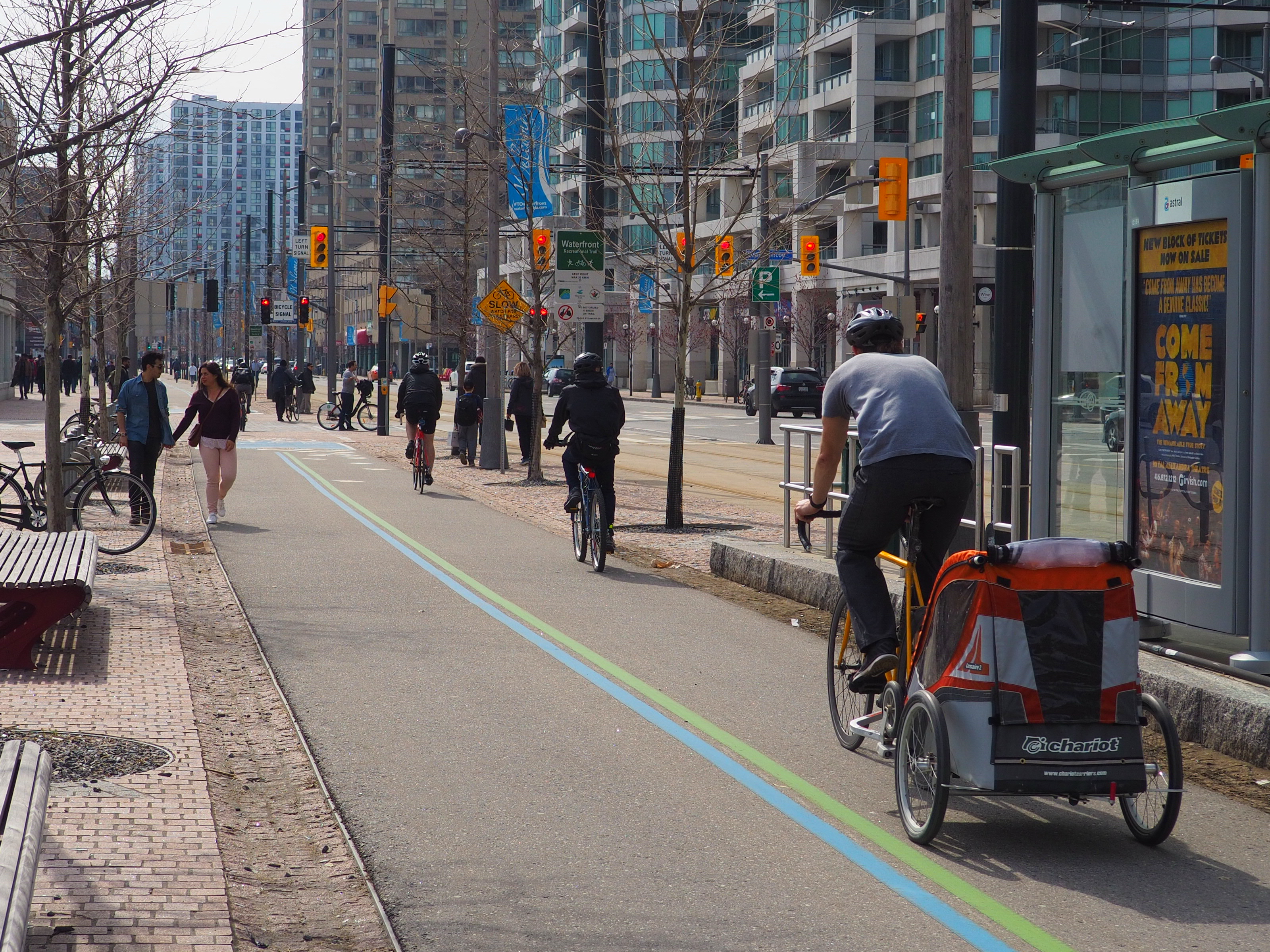 Multi-use trails are off-street facilities that are designed to accommodate people cycling and walking and other non-motorized users. Multi-use trails can be placed adjacent to a roadway or sidewalk, or be completely separated from a street, such as within a park or green corridor.
Trail projects play an important role in connecting and expanding Toronto’s cycling network. Within this network, each trail, park, bicycle lane or other component has a particular role to play. As a result, each trail needs to have certain characteristics to ensure that it can perform appropriately. Three classes of trails are identified by their role in the network.
Learn more about Toronto's Multi-Use Trail Design Guidelines ![]() .
.
When a multi-use trail (or two-way bikeway) is within two metres of the roadway, a splash guard or other approved physical separation is required between the roadway and multi-use trail or bikeway.
Share Lane Markings, or “Sharrows,” are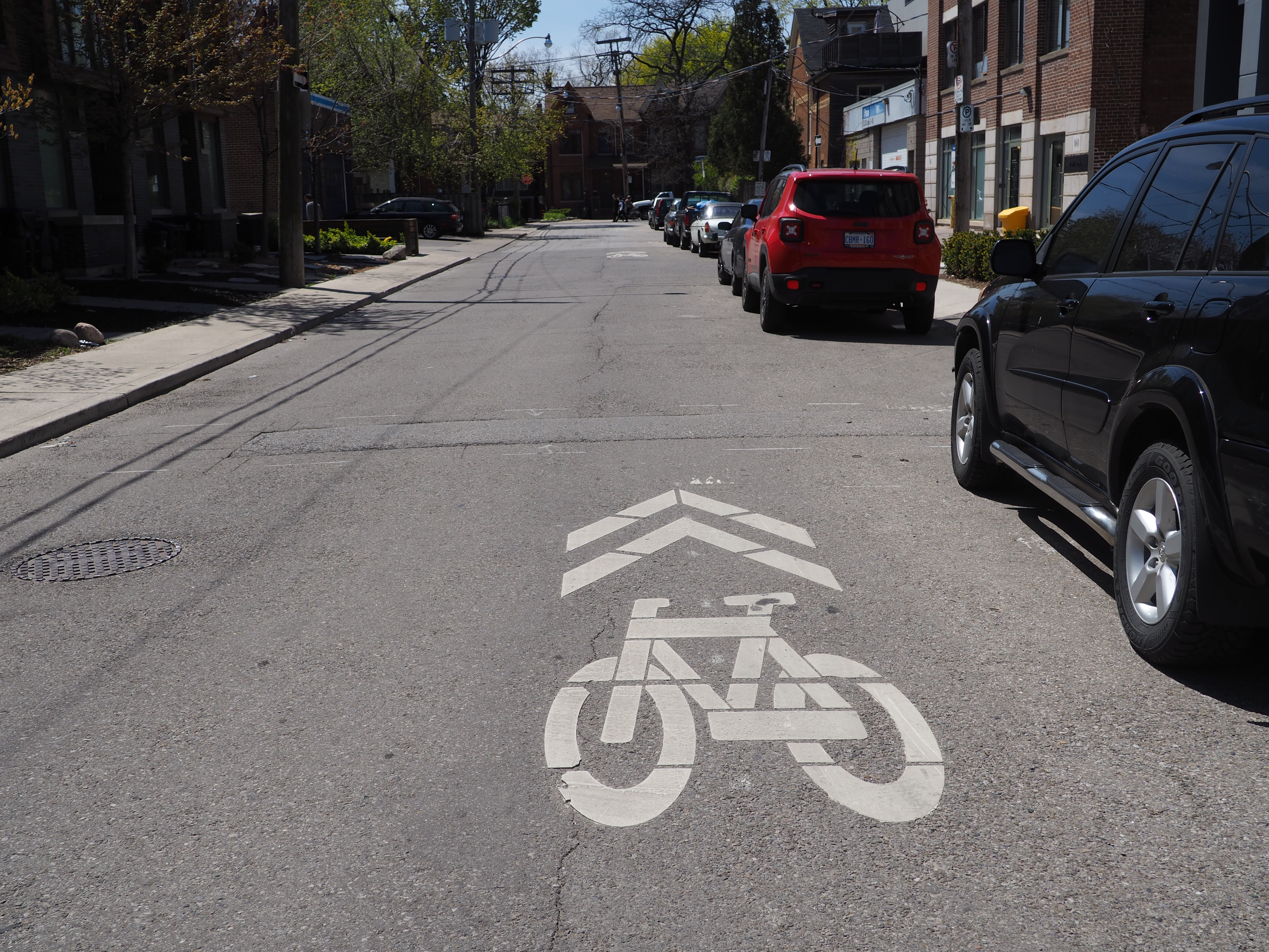 road markings used to indicate a shared environment for bicycles and motor vehicles. The shared lane markings highlight cycling routes, which alert all road users to the presence of bicycle traffic on the street, and may also be configured to offer directional and wayfinding guidance for people cycling. The shared lane marking is not a dedicated cycling facility, but a pavement marking, which has a variety of uses to support a complete bikeway network.
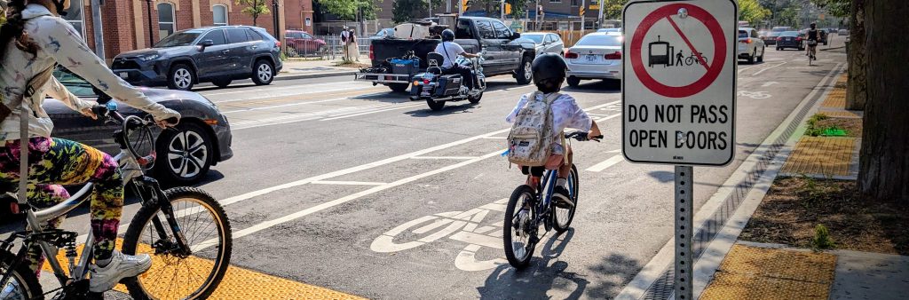
Although it is the motorist’s and/or passenger’s responsibility to look first before opening their door, riding too close to parked cars can lead to serious injuries that can be avoided.
Sharrows are also used through intersections and some merge zones to support straight-line cycling and to increase the visibility of people cycling.
 Neighbourhood Greenways are routes where people cycling and pedestrians are given priority by creating an environment with low motor vehicle volumes and speeds.
Neighbourhood Greenways typically feature speed management features, one-way streets, raised crossings, contra-flow bicycle lanes, traffic diverters, wayfinding signage and safe crossings of major roadways.
Reasons for building Neighbourhood Greenways include providing parallel routes to major corridors, reducing non-local traffic infiltration and speeds, and encouraging cycling among less experienced cyclists.
Download the Neighbourhood Greenways Guide ![]() to learn more about the benefits, criteria and features of Neighbourhood Greenways.
to learn more about the benefits, criteria and features of Neighbourhood Greenways.
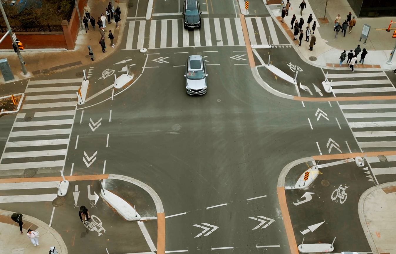 Protected intersections enhance safety for all road users by reducing the likelihood of high-speed turns and improving sightlines.
Benefits of protected intersections include:
When approaching a protected intersection:
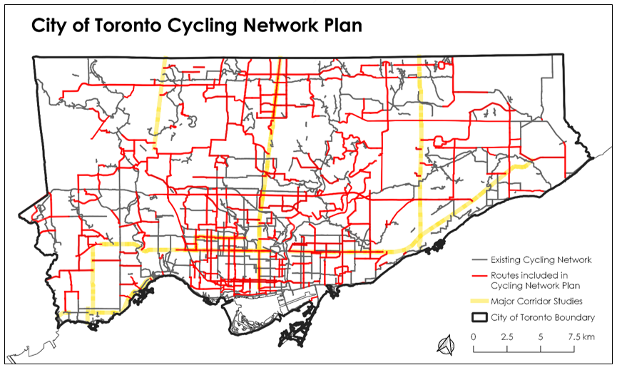
The Cycling Network Plan, adopted by City Council in 2019, seeks to build on the existing network of cycling routes to Connect gaps in the current network, Grow the network into new parts of the city, and Renew existing parts of the network to improve safety – with corresponding objectives and indicators for measuring and evaluating success.
Learn more about Cycling Upgrades & Renewals that are carried out by implementing new line markings, bundling with state-of-good repair road or water projects, or standalone cycling or intersection improvements.
Bike boxes are used at intersections to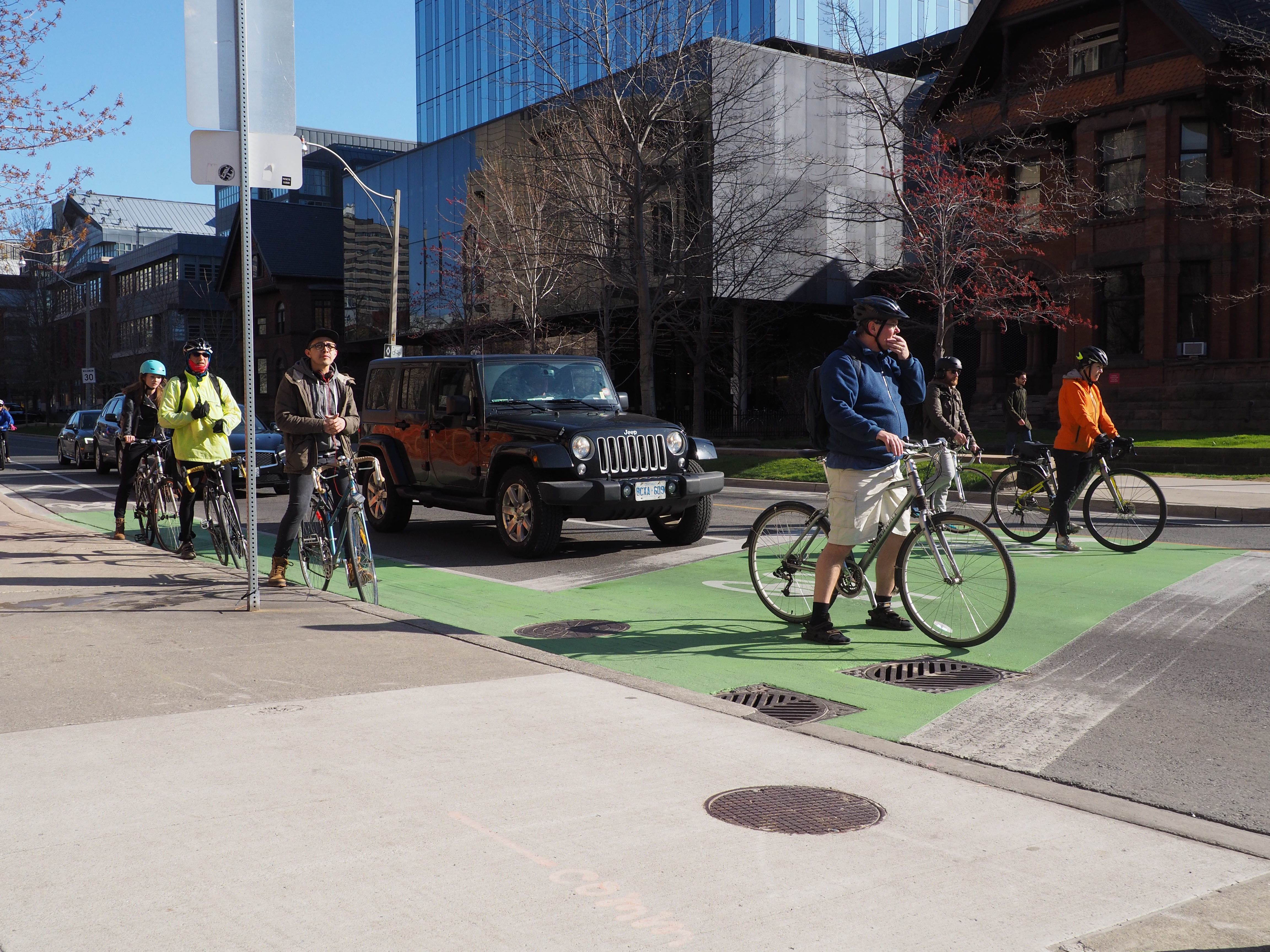 designate a space for people cycling to wait in front of motorists at the red light. People cycling should position themselves at the right, left, or centre of the bike box, depending on the desired direction of travel. They may then proceed before motorists when the light turns green. At red lights, motorists must stop at the stop line behind the bike box.
Right turns on red lights are not permitted for motorists where bike boxes are present.
Left-turn bike boxes indicate a designated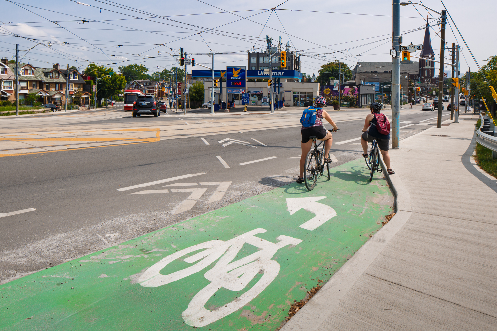 area for people cycling to safely make a left turn at multi-lane signalized intersections from a right side cycle track or bicycle lane.
Left-turn bike boxes offer several benefits to people cycling, such as providing a formal waiting space to make a two-stage turn, reducing turning conflicts between people cycling and driving, and separating people who are cycling through an intersection from those who are turning.
To use a left-turn bike box, people cycling should proceed through the intersection in the bikeway or right lane, and position themselves in the designated area while waiting for their signal, facing the direction in which they would like to travel. When the traffic or bicycle light turns green, they may continue cycling through the intersection.
Cycling-only blocks are located at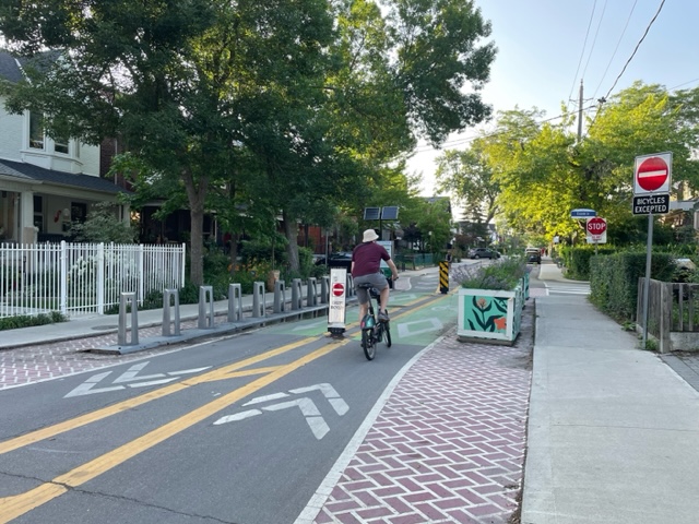 intersections and restrict travel by motor vehicles, while allowing people cycling and pedestrians to pass through.
Cycling-only blocks offer the following benefits:
 Diagonal diverters are located at four-way minor intersections, which require all motor vehicle traffic to turn in one direction only, while allowing people cycling and walking to proceed through.
Diagonal diverters offer the following benefits:
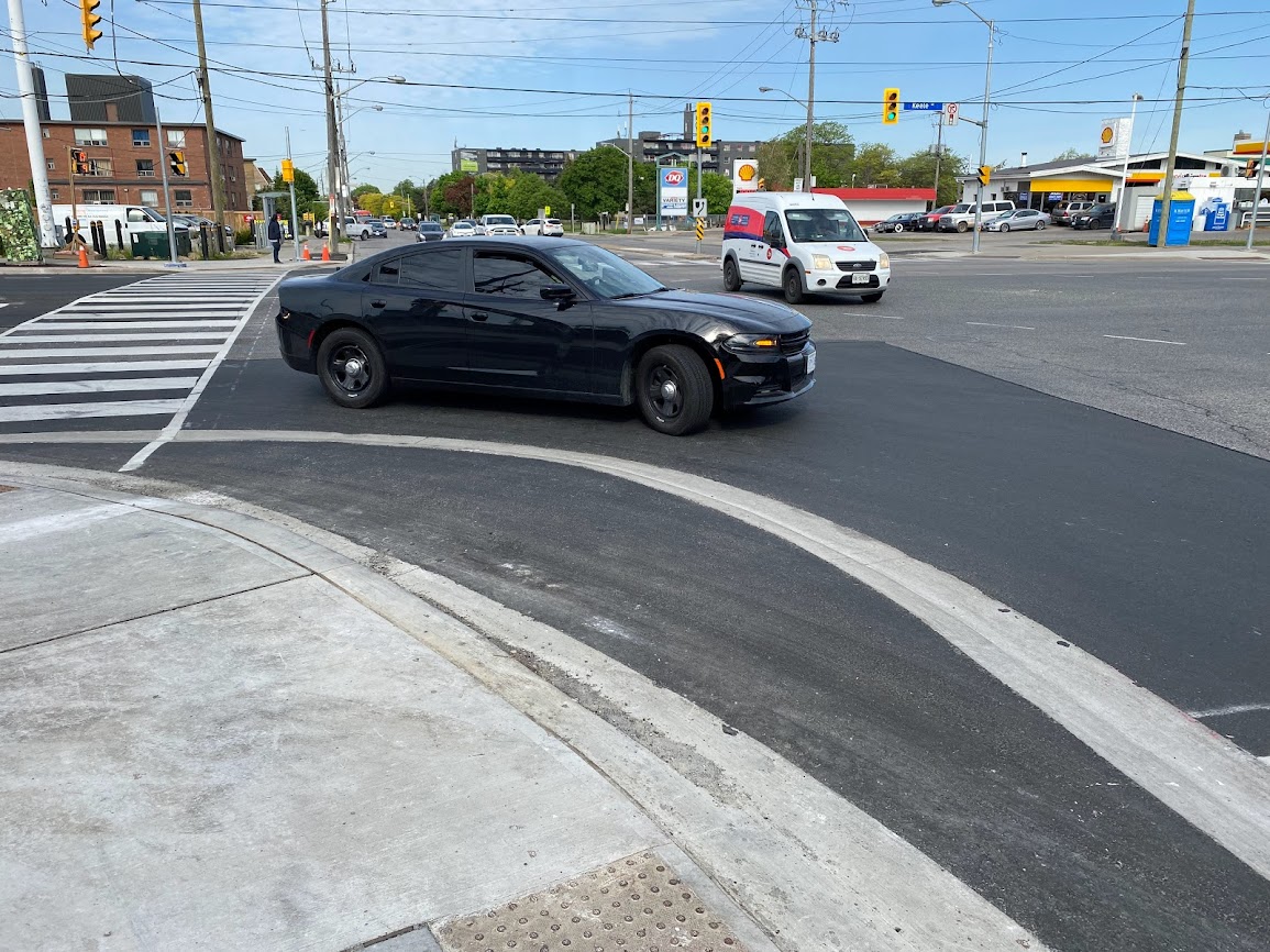 A truck apron is a mountable curb that is designed for smaller vehicles, while also accommodating larger vehicles to turn at an intersection corner. The truck apron radius is mounted by trucks when making right turns.
The truck apron radius consists of a semi-mountable curb that directs smaller design vehicles to turn at the design speed, while larger trucks are able to mount the curb when completing a right turn. Behind the truck apron is a standard sidewalk curb with a radius to accommodate all turning vehicles. At signalized crossings people walking are only to cross the truck apron portion during the corresponding walk phase and during all other phases to wait behind the sidewalk curb. At unsignalized crossings, people walking are able to cross with the same rights and responsibilities as a standard crosswalk.
Learn more about truck aprons in the City’s Truck Aprons Guidelines.
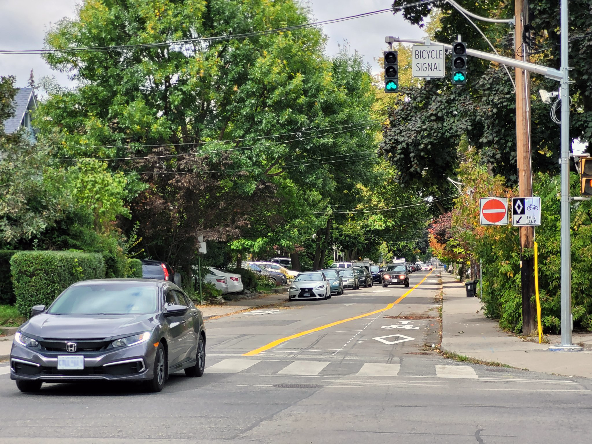
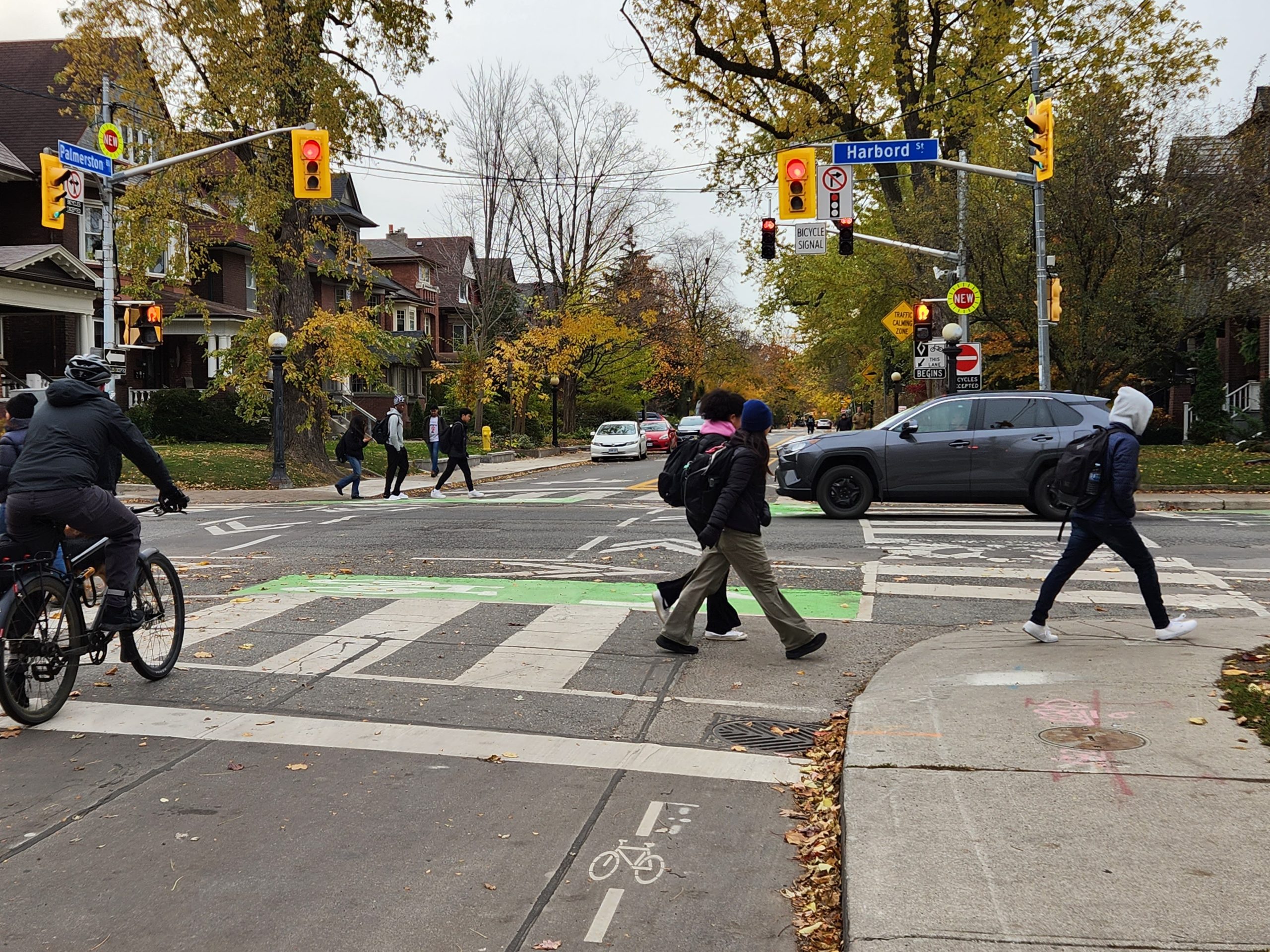
A bicycle signal directs people cycling when it is safe to pass through an intersection. These can be used for intersections on trails or contra-flow bicycle lanes where vehicles cannot drive, the transition between road to trail, or if bicycles cross the lane in a different manner than motor vehicles.
Bicycle signal heads are smaller than the usual yellow traffic signal heads and are black. Bicycle signals have a white sign attached notifying road users that is meant for people cycling.
Some intersections are equipped with Leading Bicycle Intervals (LBI), which provide people cycling with an advance head start, allowing them to begin riding before vehicles receive a green signal. The purpose of LBI is to enhance the visibility of people cycling in the intersection and reinforce their right-of-way over turning vehicles. Learn more about Leading Intervals for people cycling and pedestrians in Toronto.
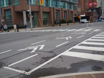 Chevron pavement markings indicate the route people cycling should take through the intersection. This increases drivers’ awareness of people cycling and makes their travel more predictable at intersections.
Green markings are used at intersections and driveways where vehicles interact with bikeways. They serve to increase the visibility of bikeways, making drivers aware of people cycling.
Bicycle detector symbols indicate where people cycling should position themselves at an intersection to be detected by the traffic signal.
There are two types of bicycle detector symbols in Toronto: those with a line through the symbol (induction loop) and those without (non-intrusive). If you see a line on the pavement, lean forward on your bike with the crank and wheels positioned on top of it inside the rectangle. The induction loop will then sense the presence of something metal, which will trigger the traffic signal to change.
 A non-intrusive detector consists of a radar, infrared, video or microwave sensor located on a traffic signal pole that is aimed down. Ensure that you are positioned either within the bike lane or behind the stop bar to be detected by the traffic signal.
While we aim to provide fully accessible content, there is no text alternative available for some of the content on this site. If you require alternate formats or need assistance understanding our maps, drawings, or any other content, please contact the Cycling and Pedestrian Projects unit at 416-397-5172 or cycling@toronto.ca.