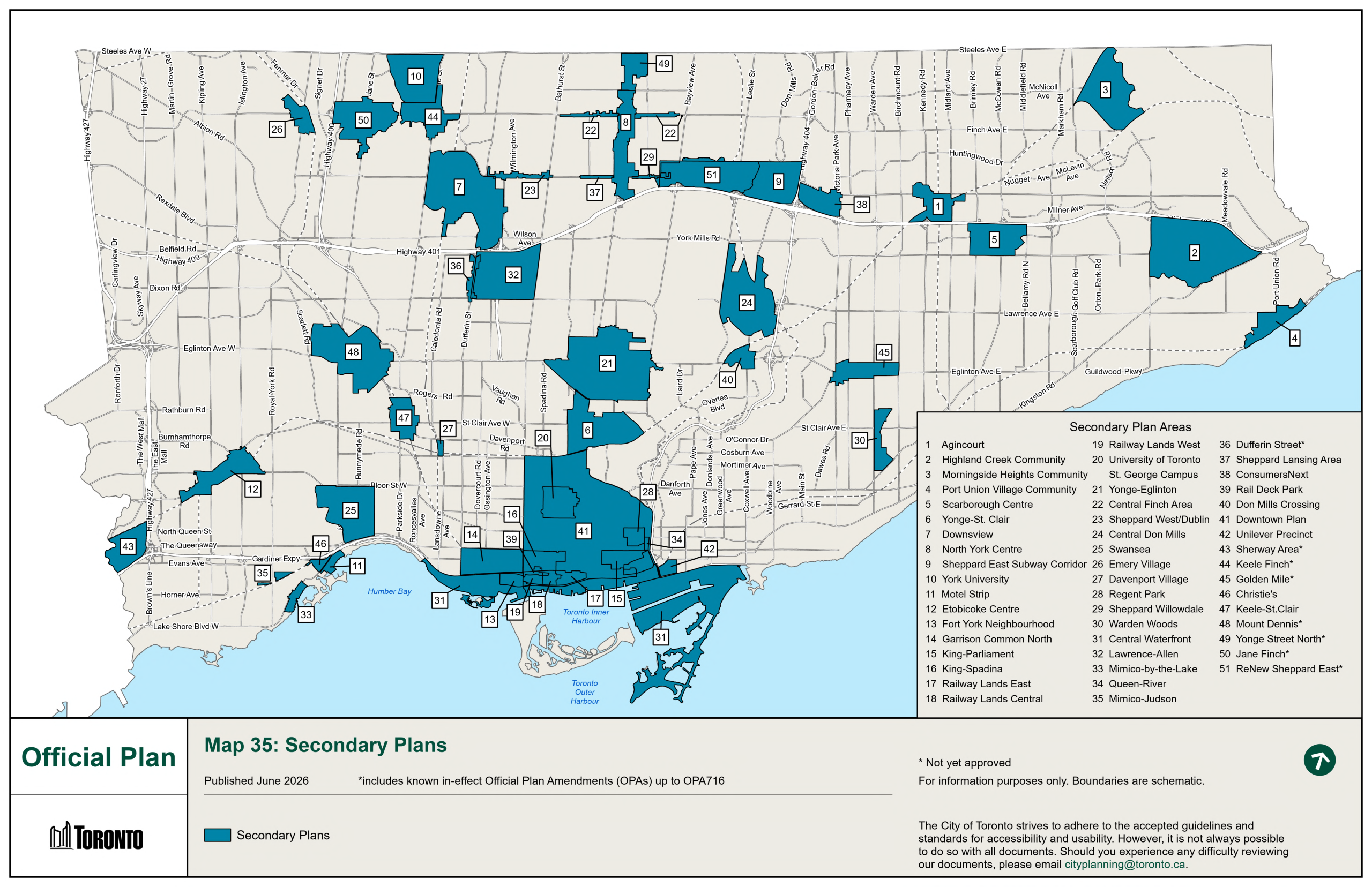
Chapter 6 contains the Secondary Plans, which are more detailed local development policies to guide growth and change in a defined area of the City.

Map 35 – Secondary Plan Key Map: This map illustrates the location and boundary of the Secondary Plan Areas of the Toronto Official Plan and the proposed new or amendments to existing Secondary Plan Areas that are yet to be approved by the Ontario Municipal Board.
Secondary Plan Key Map
 1. Agincourt  17. Railway Lands East  33. Mimico-by-the-Lake*
 2. Highland Creek Community  18. Railway Lands Central  34. Queen-River
 3. Morningside Heights  19. Railway Lands West  35. Mimico-Judson
 4. Port Union Village Community  20. University of Toronto  36. Dufferin Street*
 5. Scarborough Centre  21. Yonge Eglinton  37. Sheppard Lansing Area
 6. Yonge St. Clair  22. Central Finch Area  38. ConsumersNext*
 7. Downsview  23. Sheppard West/Dublin  39. Rail Deck Park
 8. North York Centre  24. Central Don Mills  40. Don Mills Crossing*
 9. Sheppard East  25. Swansea  41. Downtown Plan
 10. York University  26. Emery Village  42. Unilever Precinct
 11. Motel Strip  27. Davenport Village  43. Sherway Area*
 12. Etobicoke Centre  28. Regent Park  44. Keele Finch*
 13. Fort York  29. Sheppard Avenue Commercial Area  45. Golden Mile*
 14. Garrison Common North  30. Warden Woods
 15. King-Parliament  31. Central Waterfront
 16. King-Spadina  32. Lawrence-Allen  * Not yet approved