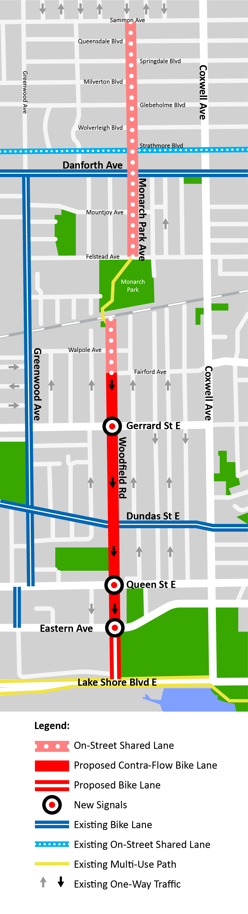
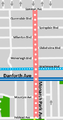
As part of the Quiet Streets Program on Woodfield Road and Monarch Park Avenue, from Sammon Avenue to Lake Shore Boulevard, the City of Toronto has:
This work was part of the City’s Council-approved Cycling Network Plan to connect, grow and renew infrastructure for cycling routes across the City. Consultation on this project took place in April 2021, with feedback received through two virtual public meetings, an online feedback form and the local Councillor. City Council approved the project in June 2021 (2021.IE22.11).
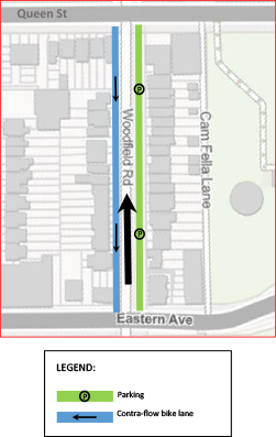
Phase 2 of installation (Queen Street East to Lake Shore Boulevard Trail) is now complete:
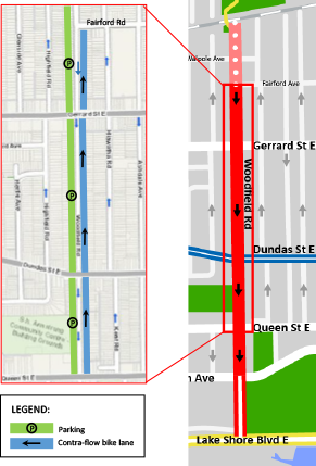
Phase 1 of installation, from Fairford Avenue to north of Queen Street East, was completed:
Motions moved by Councillor Fletcher (6:08:06); Voting on motions (Motion 3a: 6:10:10; Motion 3b: 6:10:31); Voting on amendments (6:10:55)
On June 9, 2021, following additional feedback from local residents received after IEC, City Council adopted the following amendment moved by Councillor Fletcher:
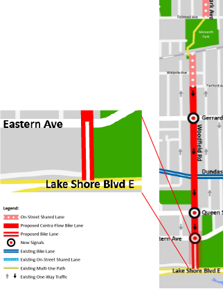
This was presented as Alternate 3 during the consultation period.
Also, as a result of overall feedback throughout the consultation process, City Council has directed the General Manager, Transportation Services to:
Deputations (pre-recess: 2:39:23; post-recess: 4:01:31; last deputant: 4:45:30); Questions of staff (4:39:51); Speakers & motions (4:52:52); Voting on items (5:22:16)
On May 25, 2021, the Infrastructure and Environment Committee (IEC) of City Council endorsed Item IE22.11 - Cycling Network Plan - 2021 Cycling Infrastructure Installation - Second Quarter Update and Missing Link Sidewalk Program - 2021 Local Road Sidewalk Installation, which included:
Item IE22.11 was moved to the June meeting of City Council for consideration.
From March 30 to April 29, 2021, local residents and stakeholders and members of the public were invited to provide feedback on the proposed changes and bikeway options to Woodfield Road-Monarch Park Avenue, from Sammon Avenue to the Lake Shore Boulevard Trail.
Two Virtual Public Meetings were held on April 14 and 15, 2021, from 7 p.m. to 8:30 p.m. The meetings were attended by 21 and 39 participants respectively.
Over 250 respondents provided feedback on the proposed design and bikeway options through an online survey.
Selecting a Bikeway for Woodfield-Monarch Park
The City of Toronto’s draft design guidelines set 75 cars in the peak hour as the maximum for a shared lane.
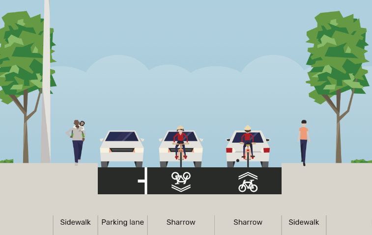
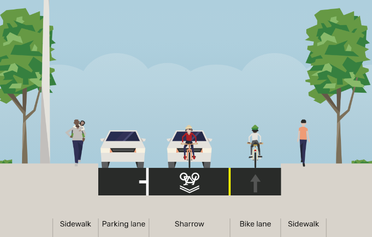
Based on the speed and volume of traffic, a shared lane for people cycling and driving is appropriate. The preferred bikeway type for Woodfield Road-Monarch Park Avenue is Neighbourhood Greenway.
The peak volumes and eight-hour volumes do not exceed the thresholds of vehicle volumes, so additional traffic diversion is not recommended.
| Average Counts | Woodfield-Monarch Park Existing Volumes | Neighbourhood Greenway Volume Thresholds |
|---|---|---|
| Peak Hour Motor Vehicles | 30–75 vehicles | 75 vehicles |
| Cycling (over 8-hours) |
70–120 cycling trips (20–30% of total traffic) | Would like to increase volume to 40–50% of total traffic |
| Vehicles (over 8-hours) |
200–400 vehicles | Less than 750 vehicles |
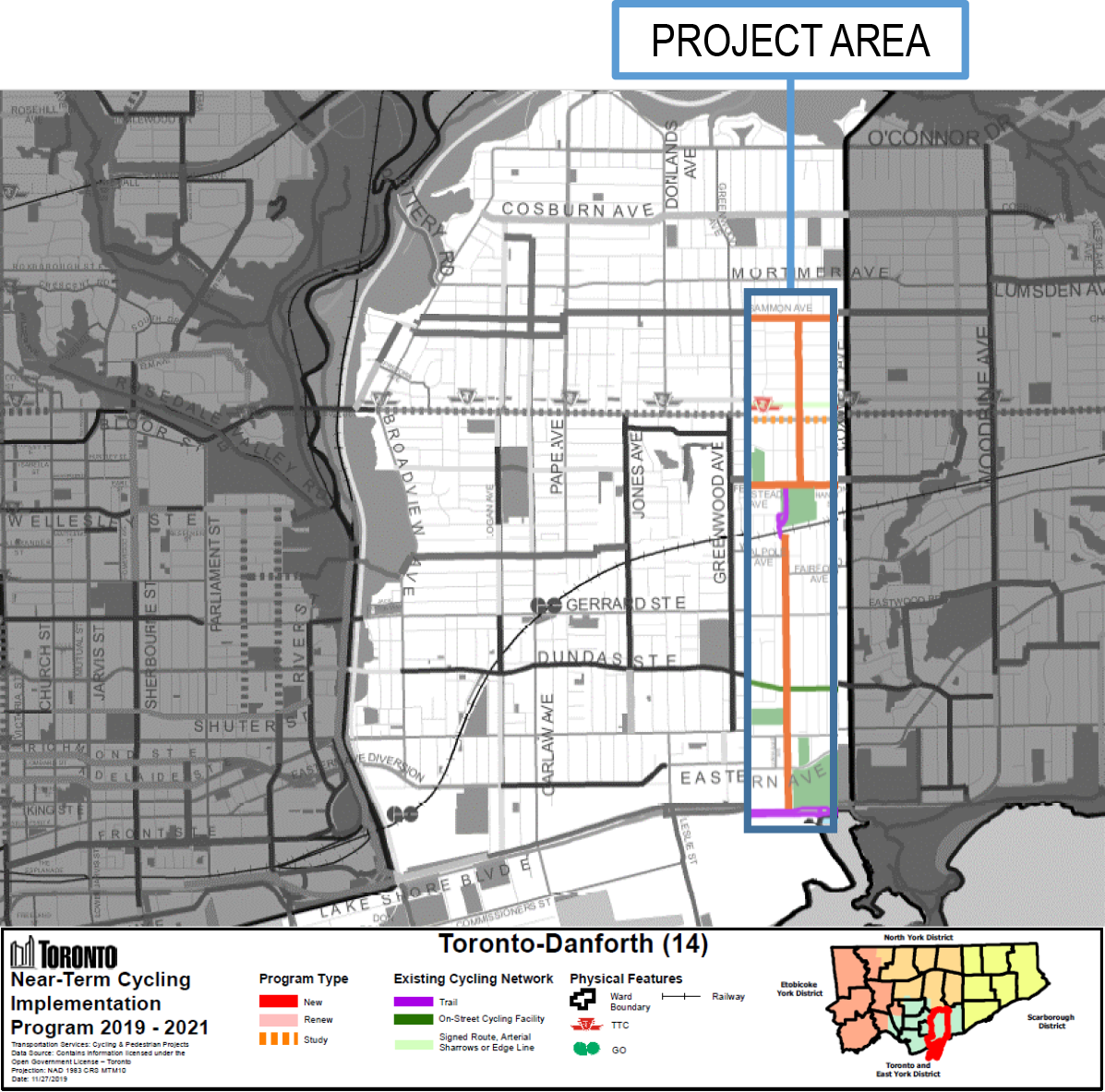
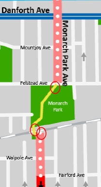
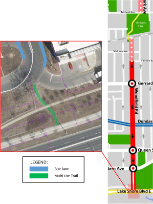
Woodfield Road-Monarch Park Avenue was identified in the Council-adopted Cycling Network Plan as a north-south route, installed in the near term (2019–21).
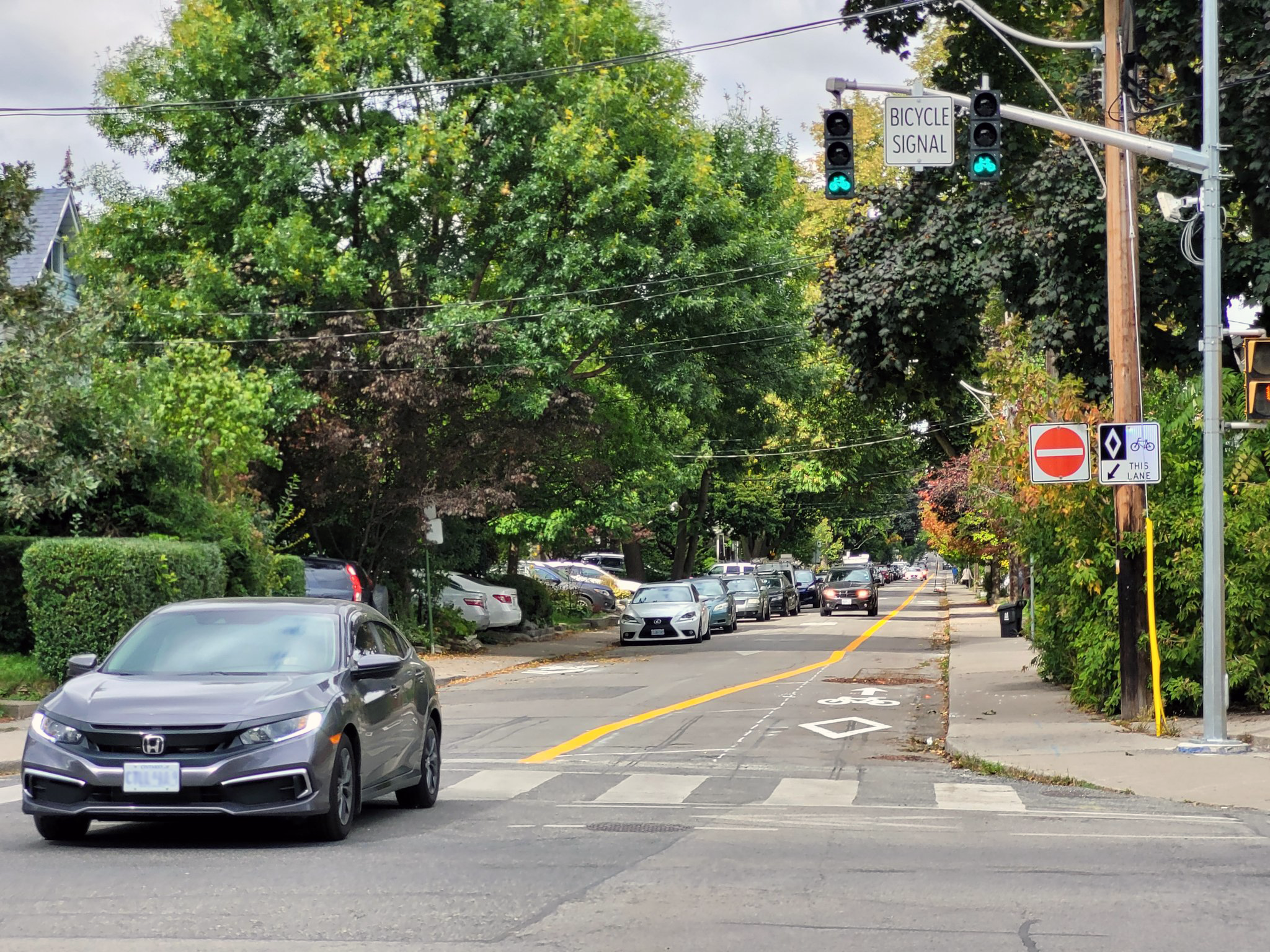
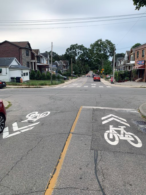
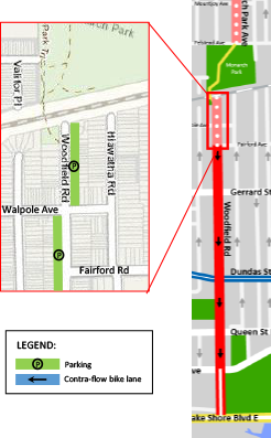
The proposal included contra-flow bicycle lanes on one-way sections of Woodfield Road and installation of traffic calming elements like painted bulb-outs, wayfinding and traffic signal upgrades at key locations.
Woodfield Road-Monarch Park Ave has been identified as a “Grow” project in the Cycling Network Plan Update. This project would grow the cycling network into new parts of the city.
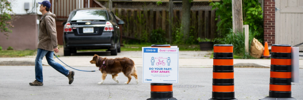
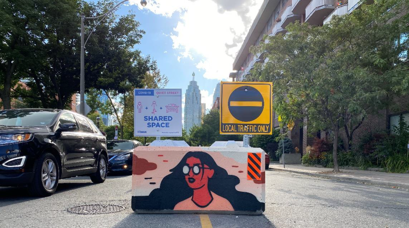
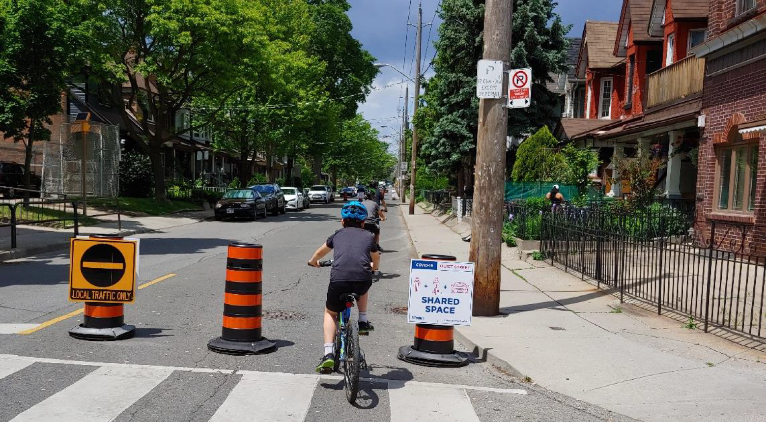
From May to October 2020, Woodfield Road-Monarch Park Avenue were designated as Quiet Streets. The ActiveTO Quiet Streets program created shared spaces to allow residents to maintain physical distancing while getting around on neighbourhood streets. Temporary signage and other measures were used to encourage slow, local vehicle access only so the street could be a shared space that welcomed people who walk, run or bike.
In 2021, City staff proposed that instead of reintroducing the seasonal Quiets Streets program, energy be refocused on programs that provide year-round improvements to local streets, such as this project.
The ActiveTO Quiet Streets Survey was conducted in the summer of 2020. There were over 700 unique responses on Woodfield Road-Monarch Park (Woodfield Avenue: 219 respondents; Monarch Park Avenue: 536 respondents).
According to those surveyed, Woodfield-Monarch Park was one of the highest-ranked routes for reducing vehicular speeds, improving physical distancing, and making people feel safer sharing the street. The feedback was very positive.
The most common feedback was concerns about non-local traffic.
| Survey Question | Woodfield Road (percentage of survey respondents) |
Monarch Park Avenue (percentage of survey respondents) |
|---|---|---|
| Understood the intent of the program | 95% | 95% |
| Walking/jogging is main mode of travel | 85% | 88% |
| No exclusive access to outdoor space | 13% | 9% |
| Do not live/work on the Quiet Street | 59% | 76% |
| Perception of program influencing physical distancing | 75% (agreed or strongly agreed) | 81% (agreed or strongly agreed) |
| Perception of program providing safer shared street space | 79% (agreed or strongly agreed) | 78% (agreed or strongly agreed) |
On April 7, 2021, City Council adopted the report, Active TO – Lessons Learned from 2020 and Next Steps for 2021.
Councillor Fletcher moved the motion, which requested the General Manager, Transportation Services, to implement, in consultation with the local Councillor, Quiet Streets on Monarch Park Avenue and Woodfield Road on a temporary basis until such time as cycling infrastructure is installed on those streets.
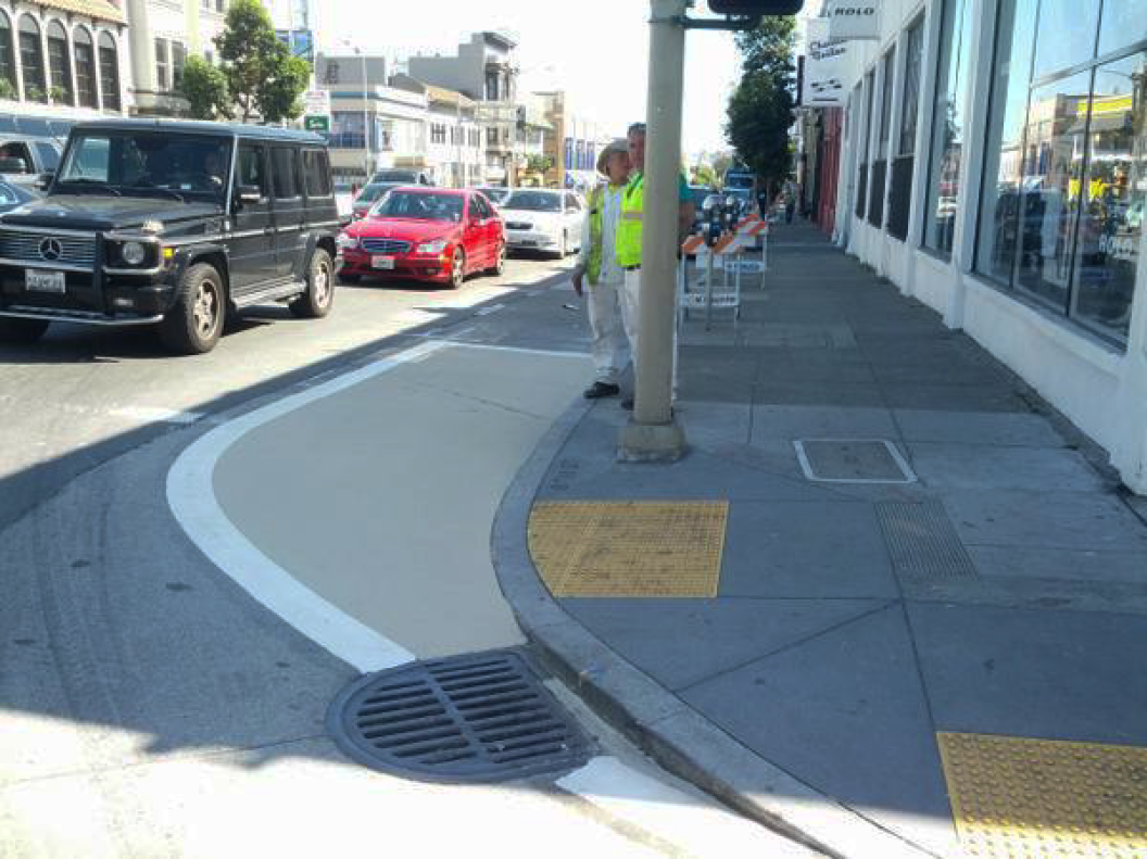
Where possible, the City installed traffic calming elements like painted curb extensions at intersections.
Traffic calming is a term associated with physical features like discourage through traffic, lower speed and improve comfort levels for all road users. Traffic calming can include one-way street flips, curb extensions, speed humps and other elements.
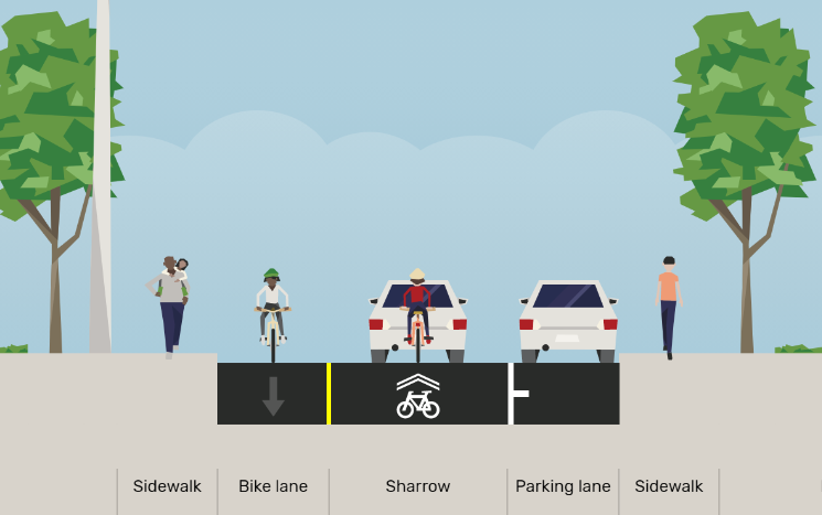
Contra-flow bicycle lanes are bicycle lanes designed to allow people cycling to ride in the opposite direction of motor vehicle traffic. They convert a one-way traffic street into a two-way street for people cycling: one direction for motor vehicles and bikes and the other for bikes only.
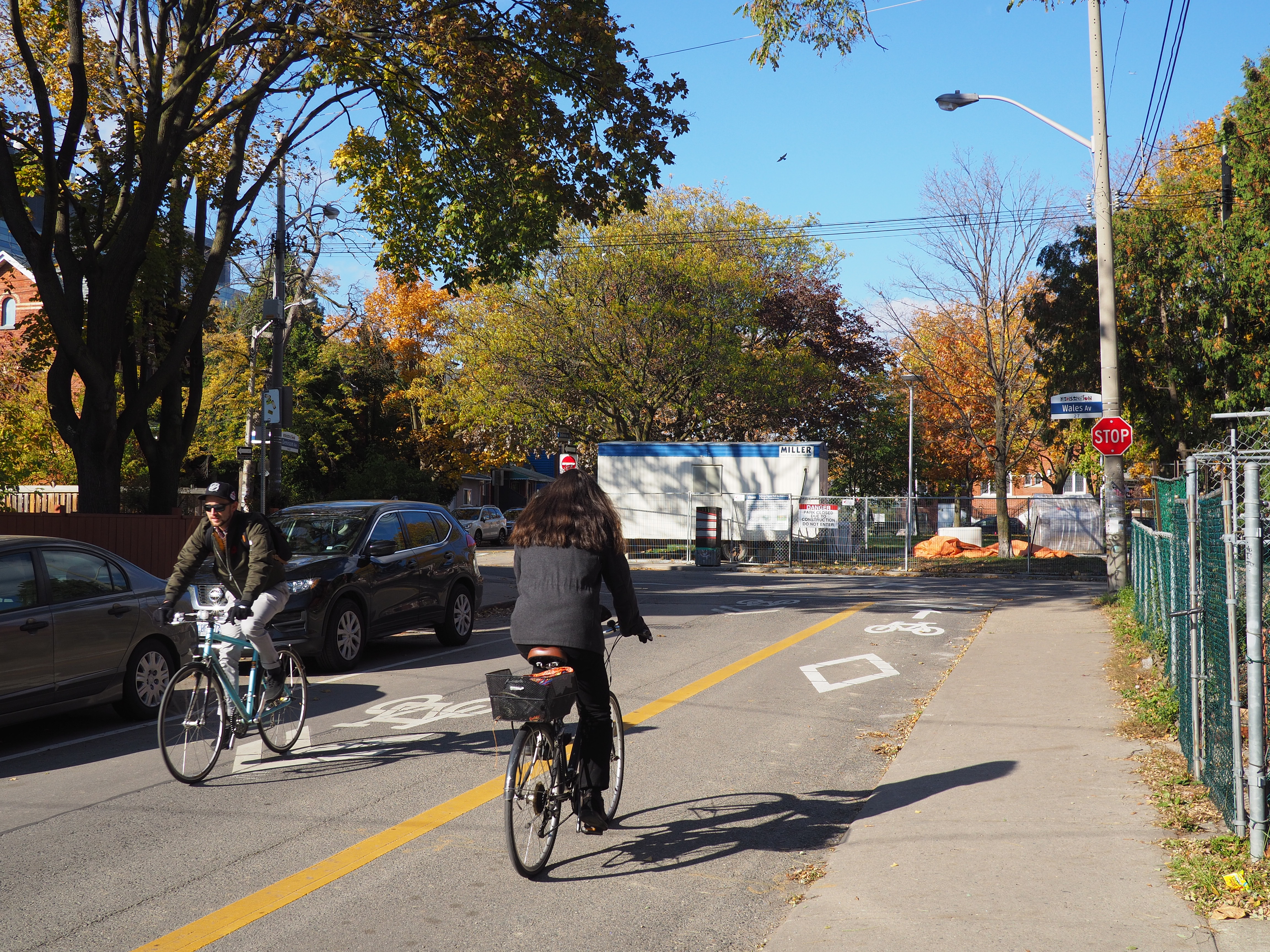
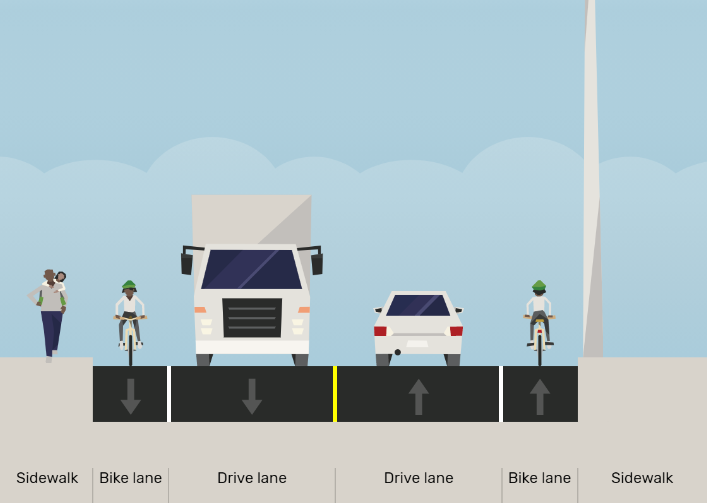
Designated bicycle lanes are a dedicated part of the roadway for the exclusive use of people cycling. Other road users may not lawfully drive, stand, stop or park in a designated bicycle lane.
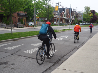
On low volume, residential streets shared lanes for people cycling and driving can be effective and can include signs, wayfinding pavement markings and other traffic calming to create comfortable cycling routes.
Need assistance? While we aim to provide fully accessible content, there is no text alternative available for some of the content on this site. If you require alternate formats or need assistance understanding our maps, drawings or any other content, please contact cycling@toronto.ca.