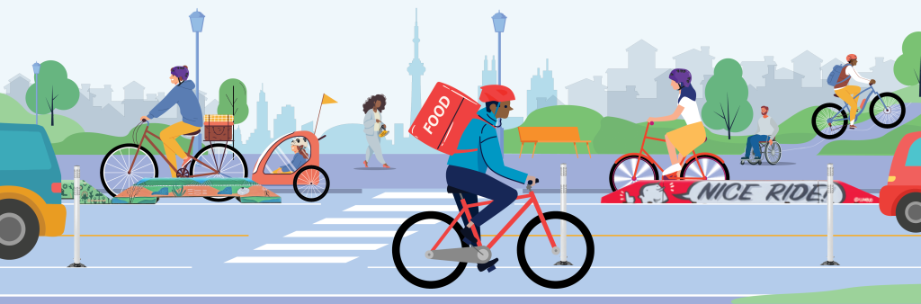
The City is working to make travel by bike safer and more inviting, which helps ease congestion, creates a cleaner environment, and promotes physical activity. One way to achieve this goal is by building bikeways, like physically separated cycle tracks, bike lanes, neighbourhood routes, and paved multi-use trails. Together, all these bikeways make Toronto’s Cycling Network.
View maps of the 2025-2027 Program and Major City-wide Cycling Routes.
Learn more about the history and details of the Cycling Network Plan below.
The Cycling Network Plan (CNP) serves as a comprehensive roadmap and work plan, outlining the City’s planned investments in the near-term and intentions for the long-term. The CNP is grounded in many City policies and strategies, including the Official Plan, the Road to Health, Vision Zero Road Safety Plan, TransformTO Climate Action Strategy, Complete Streets, and key recommendations in the Toronto Office of Recovery and Rebuild’s Impacts and Opportunities report.
The CNP is an evolution of the Ten Year Cycling Network Plan, approved in principle in June 2016 and a culmination of significant research, analysis, and extensive public consultation. In 2019, 2021, and 2024, the Cycling Network Plan was updated to continue to build on the work of the Ten Year Plan, including updated data sources; a revised approach to short-term programming and long-term planning that better reflects the nature of capital coordination, development planning, and challenging feasibility assessments; a strengthened focus on safety, equity, and connectivity; and an enhanced prioritization framework.
The CNP’s project mandate is to:
The CNP has three main components: the Long-Term Cycling Network Vision, Major City-Wide Cycling Routes, and a rolling three-year Near-Term Implementation Program.
The Cycling Network Plan has a rolling three-year near-term implementation program. This approach is flexible and adaptable to the realities of infrastructure planning and capital coordination. Transportation Services regularly reviews the capital implementation program and every three years brings forward new routes based on the cycling network near-term program prioritization framework. The framework includes strategic alignment with the state-of-good-repair road program, road safety focus areas, and planning focus areas; extensive cycling impact analyses (such as collision analysis and transit access); and takes into account the feasibility, complexity, and delivery methods of proposed design options. The framework applies an equity lens, which is informed by community engagement, geographic distribution, and a neighbourhood cycling and equity index.
Cycling Network Near-Term Program Prioritization Framework
The current Near-Term Implementation Program was adopted for 2025-2027. The program commits to delivering 100 km of new and major upgrade bikeways, 40 km of renew projects, and many studies for future implementation.
View maps of the planned bikeways:
2025-2027 Cycling Program Table
The second Near-Term Implementation Program was adopted for 2022-2024. The program proposed approximately 100 km of new bikeways, as well as upgrades to existing routes and studies for future implementation. By the end of 2024, it is expected that 75 km of new bikeways will be completed, and 48 km of bikeways will be renewed.
Map of Completed 2022-2024 Projects
Maps of the 2022-2024 Program:
2022-2024 Near-Term Program Table
The first Near-Term Implementation Program was adopted for 2019-2021. The 2019-2021 Near-Term Program committed to approximately 65 km of new bikeways, as well as upgrades to existing routes and new feasibility studies.
Note: All kilometres referenced on this page and in the report are centreline kilometres, which measure the length of the road / trail segment. This is different from lane kilometres, which count infrastructure on both sides of the street.
Every street in Toronto should be considered for bikeways and other cycling upgrades. Toronto’s Cycling Network Plan diverges from traditional cycling route plans in North America. Route plans identify streets that should be considered for cycling, but Toronto’s Cycling Network Plan does not limit cycling to a specific set of streets. To fulfill the long-term vision of the Cycling Network Plan, every street through development applications, area studies, and capital projects should consider and incorporate bikeways. Just like every street re-design considers people driving and walking, the same should be for cycling.
Not all streets are created equal. Some streets bring greater value to the cycling network, as illustrated by the four categories of cycling service assessment used in the long-term vision, which can be viewed below. The categories are based on the 2019 cycling impact analysis (current and potential cycling demand, trip generators, transit access, connectivity, coverage, barriers, safety, and Neighbourhood Improvement Areas).
Individual analysis categories were updated for the 2025-2027 Cycling Network, but the next comprehensive update for the long-term vision will be undertaken when the results of the latest Transportation Tomorrow Survey are available.
Many of the routes in the long-term cycling network vision have not yet undergone a feasibility review. They are included in the network because the cycling analysis demonstrates value, but assessing every route’s technical feasibility at this stage is not possible. In some cases, immediately parallel routes score well and are shown on the map to capture all possibilities. In these cases, further analysis and consultation will confirm the preferred route(s) as they are brought forward to the near-term implementation program.
Long-term Vision by Analysis Scores Map (2019)
The Cycling Network Near-Term Implementation Prioritization Framework, most recently updated and applied for the 2025-2027 Program, has nine categories in the Cycling Impact Analysis section of the framework:
These categories reflect only the cycling impact analysis section of the prioritization framework, which is separate from technical requirements such as feasibility reviews, cost and complexity, and capital coordination.
As part of the framework’s equity lens, the Neighbourhood Cycling and Equity Index Map was also updated with the most recent data available. This map shows the overlay of two variables:
There are a number of significant corridors that cross Toronto from east to west and north to south, where high order cycling infrastructure has been installed, or is underway, or planned. These Major City-Wide Cycling Routes support a connected system across the Greater Toronto Area by linking with other cycling routes in neighbouring municipalities. These cycling routes complement those identified in broader Provincial and City Plans including the Metrolinx Regional Cycling Network Plan and TOcore.
The network of Major City-Wide Cycling Routes consists of approximately 500 centreline km. Before the adoption of the 2019 Cycling Network Plan Update, there were about 170 km of Major City-Wide Routes in place. By the end of 2024, approximately 230 km were constructed, or 46% of the network.
Major City-Wide Cycling Routes
The type of study needed for each corridor will take different forms for different streets depending on the corridor’s complexity of current and future uses, and the associated impacts. Some routes may include analysis of parallel streets to confirm the most feasible alignment of the route. All studies will be undertaken with a Complete Streets and Vision Zero approach to road safety, and all projects include public consultation and stakeholder engagement before seeking Council approval to install.
On June 9, 2016, Toronto City Council approved the 10 Year Cycling Network Plan to connect, grow and renew infrastructure for Toronto’s cycling routes. On July 17, 2019, Toronto City Council approved the 2019 Cycling Network Plan Update, which provided a new timeframe (near-term program and long-term vision) to improve road work coordination, accountability, and implementation. On December 15, 2021, Toronto City Council approved the 2021 Cycling Network Plan Update, which included the next roll out of the near-term program, and recommended increases to budget and staff capacity. On June 26, 2024, Toronto City Council adopted the Cycling Network Plan Update (2025-2027), including endorsement of the next three-year program and initiation of many Major City-Wide Cycling Routes. Links and details are listed below.
City Council Decision, Recommendations, Staff Report and Attachments
In the fall of 2023, the City of Toronto received input from over 10,000 people sharing opinions, local insights, and advice on the future of the Cycling Network.
The City received over 9,000 survey responses, over 5,000 comments on the interactive map, and hundreds of participants in virtual meetings and in-person events. Participation included people from every demographic, from all parts of the city and from all types of road users including people who cycle frequently, occasionally, and not at all.
Thank you to everyone who took the time to contribute input to help support road safety in Toronto. For more information and to read the Public Consultation Report, visit the Cycling Network 2025-2027 Public Input page.
City Council Decision, Recommendations, Staff Report and Attachments
Stakeholder engagement for the 2021 Update was focused on key city-wide stakeholder groups at the plan level, and then each individual bikeway project will have a focused public consultation and engagement program made available online on the City’s Cycling & Pedestrian Public Consultations webpage as each project advances. Councillor briefings by district were held in the month of May. Two invite-only external stakeholder briefings were held in early June, one for community groups and institutions, the other for partner agencies and neighbouring municipalities.
External Stakeholder Briefing Meeting Summary and Slide Deck
City Council Decision, Recommendations, Staff Report and Attachments
Stakeholder engagement for the 2019 Update was focused on Neighbourhood Improvement Areas (NIAs) and feedback from local Councillors. From January to June 2019, Transportation Services staff attended 15 Neighbourhood Planning Tables, located in and representing the 31 NIAs. In total, there were over 400 participants at these Tables, where Transportation Services staff provided background on the Cycling Network Plan and update underway, and coordinated a mapping activity for input on key access destinations in neighbourhoods, and learned about neighbourhood-specific barriers to cycling.
City Council Decision and Recommendations
The 2016 Ten Year Cycling Network Implementation Plan details the public consultation, research process, analyses and coordination involved in the development of the 10 Year Cycling Network Plan, which has been incorporated into the Cycling Network Plan Update.
Table of Contents & Sections 1-4
Section 5 – Mapping the Potential to Impact Cycling in Toronto
Section 10 – Recommended Ten Year Cycling Network Implementation Plan
Appendix A – Ten Year Cycling Network Implementation Plan Maps (City-Wide, District and Ward)
Appendix E – Cycling Network Outcomes for Various Implementation Plan Scenarios
View City of Toronto previous ward maps (44-Ward Model) of the original Ten Year Cycling Network Plan.
2012 Bikeway Trails Implementation Plan
In 2012, Toronto City Council adopted the Bikeway Trails Implementation Plan – a planning document which was the basis for moving forward with new multi-use trail development within the city. The Plan called for seventy-seven (77) kilometres of new trails to be built within a ten-year time frame and identified priorities for upgrades to the city’s existing trail network and a program that supports future trail building (including design guidance). In 2016, the network and routes established through this plan were re-evaluated and either carried forward or revised as per the 2016 Cycling Network 10 Year Plan.
2001 Bike Plan
Prior to the 10 Year Cycling Network Plan, the City created the 2001 Bike Plan. This plan set out integrated principles, objectives and recommendations regarding safety, education and promotional programs as well as cycling related infrastructure, including a comprehensive bikeway network.
While we aim to provide fully accessible content, there is no text alternative available for some of the content on this site. If you require alternate formats or need assistance understanding our maps, drawings, or any other content, please contact cycling@toronto.ca.