This page includes studies and City Staff Reports, which will be added as they are completed.
Final Report – December 2020
Two Official Plan Amendments (for a Secondary Plan and for two Protected Major Transit Station Areas) were recommended through a Final Report presented to Planning and Housing Committee in December 2020. Planning and Housing Committee accepted the recommendations, which were sent to City Council. City Council endorsed the Amendment for the Secondary plan and adopted the Amendment for Protected Major Transit Station Areas. These Amendments are a result of work and consultation between the latter half of 2018 and into early 2020, and builds on work completed in earlier phases of the Study. The Plans incorporate results of a noise, air quality and safety study, and the results of further research, technical assessment and public input. The Official Plan Amendments are intended to provide a balanced official plan framework to encourage growth, place-making and community building, leverage transit investment and provide for compatible land uses and built form.
Interim Report – June 2018
In 2017 and early 2018, significant components of work were completed. This includes research, technical assessments, a public realm concept plan, community services and facilities profile, public and stakeholder consultation. This work had led to the identification of a preferred concept and set of directions for the Keele Street and Finch Avenue West area. The Interim Report discusses the process and work to date and includes the directions and a preferred concept, and recommends that a Secondary Plan be drafted. The Report also recommends that public consultation take place regarding the draft.
Further technical study by consultants on environmental evaluation and monitoring, and transportation consultants on a mobility plan may result in further refinement to the directions, which will be addressed in a final report.
Phase 1 – Study Initiation – November 2016
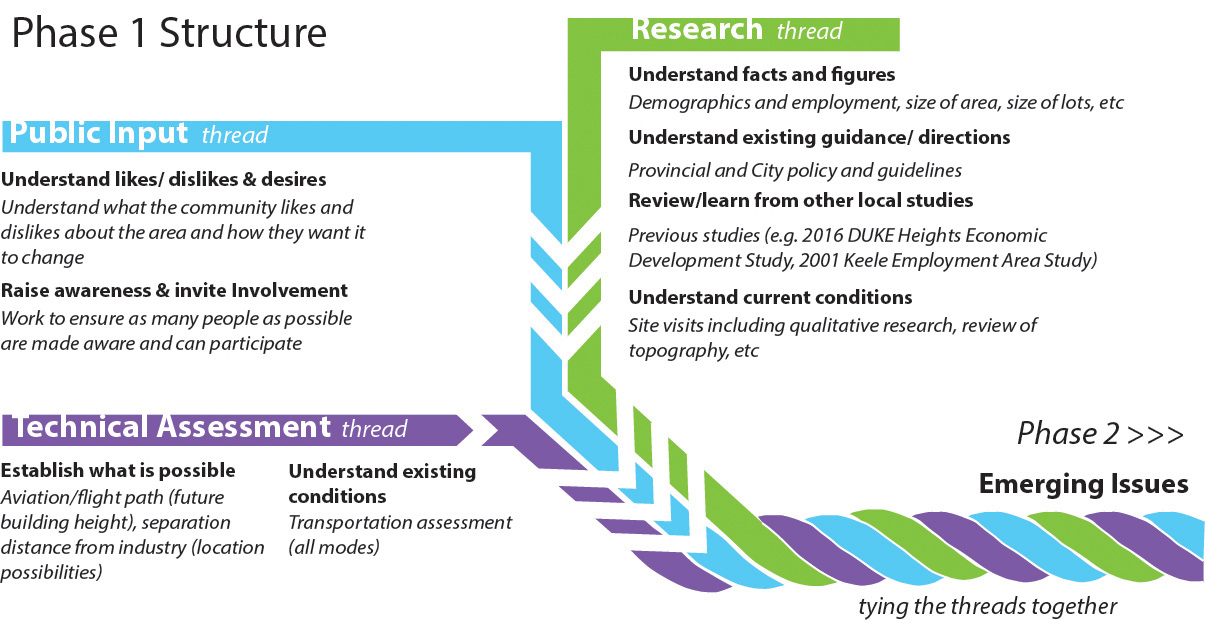
In May 2016, City Planning launched the Keele Finch Plus Study. This Staff Report provides a summary of Phase 1 of the Study. The Report includes discussion of the context and area from a location and policy perspective. It also covers taking stock of the area, including three technical analyses: environmental related to nearby industry, aviation related to Downsview Airport (the Keele Street and Finch Avenue West intersection is under the flight path) and a transportation conditions review. Results and input from public consultation is a key consideration as well. All together, results of public input, technical analyses and research have resulted in findings and emerging issues to guide Phase 2 of the Study. Read about it in the Staff Report and Attachments below.
Keele Finch Plus - Encouraging Growth and Community Building - Phase 1 Report
Consultant Study: Built Form and Visualization Report
Consultant Study: Downsview Airport Needs Assessment Report
The appendices for this report are drawings of the Obstacle Limitation Surface using TP 312 version 4 and version 5, which are Transport Canada Standards and Practices for the operation of Aerodromes (i.e. airports). The technology to convert the maps on this page to an accessible format is not currently available. These maps may not be compatible with screen reader software. If you are unable to access these maps, please contact Matt Armstrong, City Planning at 416-392-3521 or matt.armstrong@toronto.ca. Version 4 Plot A, Plot B. Version 5 Plot A, Plot B.
Consultant Study: Existing Environmental Conditions Report
Consultant Study: Noise, Air Quality and Safety Study Report
City Planning, Transportation Planning Study: Existing Transportation Conditions
Consultant Study: Final Transportation Study
Appendices to this report are available on request.
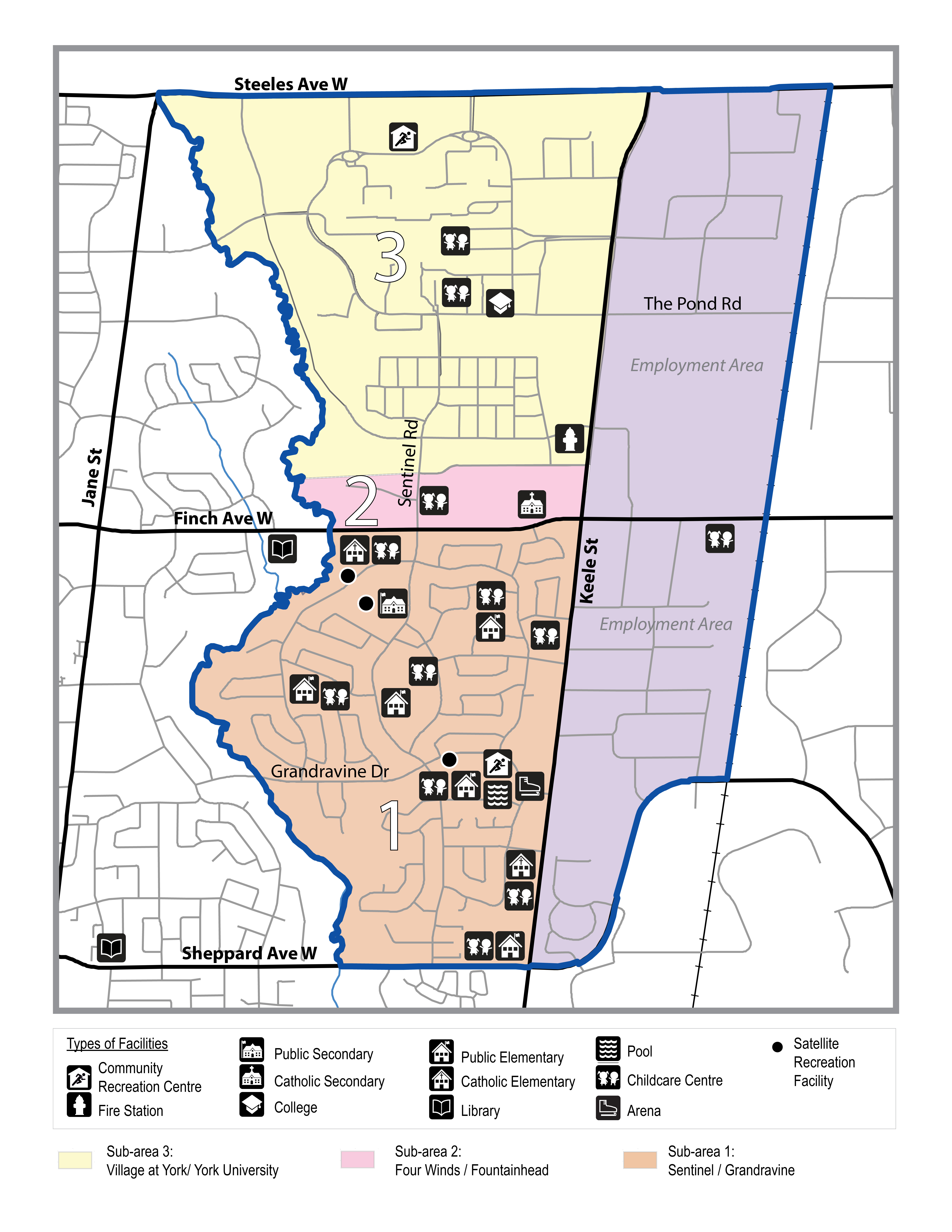
Community Services & Facilities Profile – December 2017
The goal of the Profile work was to provide a comprehensive inventory of existing community services and facilities serving the Study Area, including current service levels, utilization rates and capital plans. It examines changes in demographics over the past three census years and identifies emerging priorities to meet current and future community infrastructure needs in the area. The Profile was developed in collaboration with a number of City Divisions, agencies and boards, and informed by a survey of local community agencies, stakeholder meetings and a variety of public consultations.