Waterfront East Transit is a higher-order transit service that will operate along Toronto’s eastern waterfront.
The project spans approximately 3.8 kilometres along the Eastern Waterfront to Ookwemin Minising. A new dedicated surface right-of-way will be built along Queens Quay East to Cherry Street, and along Cherry Street and Commissioners Street to the new island on Toronto’s waterfront, Ookwemin Minising.
Toronto’s eastern waterfront is in the midst of an exciting revitalization, and the City recognized the need for higher-order transit that extends along the Eastern Waterfront to Ookwemin Minising. In April 2019, City Council directed City Staff, Waterfront Toronto and the TTC to to commence the preliminary design and engineering phase for what would become the Waterfront East Transit project.
Design work has steadily progressed to the most recent project update in February 2025, where Council directed City Staff, Waterfront Toronto and the TTC to continue bringing the Waterfront East Transit project forward by advancing the design of the project and delivering a plan to define the segmentation and sequencing of project delivery.
The completion of this work will be a major project milestone, and will be presented to Council in 2026.
An overview of plans for the extension of Waterfront East Transit along the Eastern Waterfront to Ookwemin Minising. This project will provide higher-order transit service connecting rapidly growing parts of Toronto’s Waterfront.
The videos below split Waterfront East Transit into three segments, and the City is currently refining its plans for segmentation and sequencing of this work. More information about Waterfront East Transit delivery will be shared at a later date.
The City of Toronto, Waterfront Toronto, and the Toronto Transit Commission (TTC) have published the Notice of Completion for the Transit and Rail Project Assessment Process (TRPAP), in support of the Waterfront East Light Rail Transit (LRT) network. The updated Environmental Project Report (EPR) is now available for a 30-day final review period, and the EPR and Notice of Completion can be found at the links below.
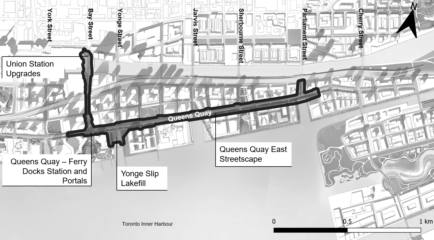
The Waterfront East LRT network comprises an LRT line that would connect Union Station with Toronto’s eastern waterfront. We completed a Transit and Rail Project Assessment Process (TRPAP) for the area of the network spanning from Union Station extending south underneath Bay Street and east on Queens Quay (see figure below). This TRPAP is intended to replace the previously approved 2010 East Bayfront Transit Class Environmental Assessment (EA), which has since expired. Areas of the network to the east of the future Street A are covered under other approved environmental assessments (refer to Exhibits 1.1 and 1.2 of the EPR, below, for more details). This project will bring much needed higher order transit service from Union Station to the eastern waterfront for current and future residents, visitors, and workers.
Materials and notices related to the TRPAP are provided on this webpage, including the final EPR.