The City maintains all underground and above ground utility maps. These maps include:
For information about sewer or water service connections call 311 or email TWC@toronto.ca
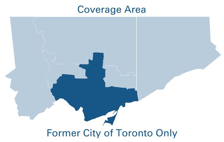
The Digital Map Owners Group (DMOG) consists of seven members. DMOG members share in the cost of maintaining the utility maps in the former City of Toronto.
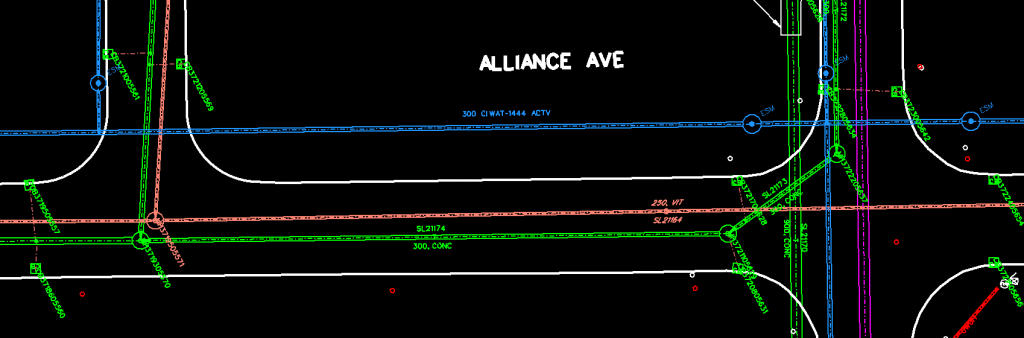
This is the single most comprehensive database of underground utility features. Utilities are being represented as double line features. DMOG maps also include relevant mapping information. This information includes: right-of-way and street curbs.
 Tiling Scheme: DMOG Block Index
Paper Map Size: 35″ x 26″
Total Number of Sheets: 5,260
Coordinate System: MTM NAD 27
Colour: Black and white print
Data Source: DMOG mapping (as-built and survey data)
Design Scale: 1:200
Available Formats:
Note: Price subject to change. HST not included. Purchaser must sign a data release form.
City Utility Mapping (CUMAP) data shows the sewer or watermain network data. The sanitary sewer, combined sewer and storm sewer networks include:
The water network includes:
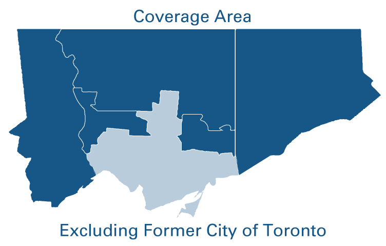
The maps are available within the former borough of East York and cities of Etobicoke, North York, Scarborough and York.
Separately purchased, if required, features include:
For former City of Toronto area coverage, go to Digital Map Owners Group (DMOG) map.
 Map Area: User defined
Coordinate System: MTM NAD 27
Data Source: City sewer and water network mapping: current
Map Scale: varies
Available Format: DGN or DWG
Series:
Price: $ 260.00 per km²
Note: Price subject to change. HST not included. Purchaser must sign a data release form.
To request an Engineering Drawing for sewers, watermains and road works in electronic format email EngDrawings@toronto.ca or phone 416-338-7954.
For water or sewer service connections, call 311.
For each drawing, a processing fee of $67.55 + HST applies, payable by credit card.
Note: Prices listed in Municipal Code Chapter 441 Appendix C - Schedule 1
Purchaser must sign a digital data release form for digital map orders.
All prices are subject to HST.